Route Editor

| Guide | ♦ | 3 Triplogs | 0 Topics |
details | drive | no permit | forecast | route |
stats |
photos | triplogs | topics | location |
| 45 | 3 | 0 |
Canyons are inherently risky. Flash floods occur without notice on sunny days. Technical skills & surrounding topography knowledge required yet does not eliminate risk.
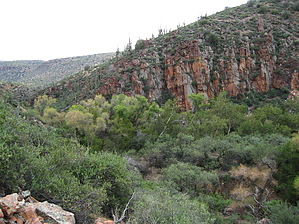
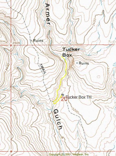
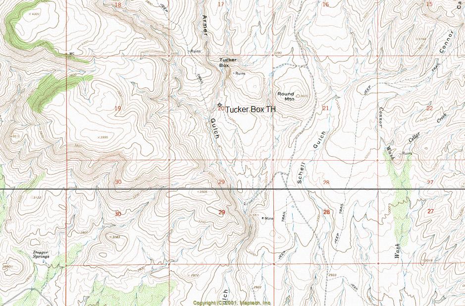
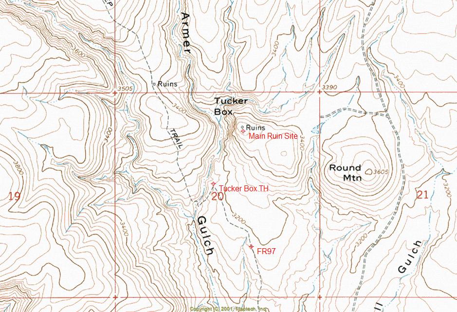
Desert Oasis by ssk44   Tucker Box is a rarely visited desert oasis located in a canyon called Armer Gulch, in the hills north of Roosevelt Lake's hills within the Tonto National Forest. This is one place that people will see on their map but typically never actually go there. The riparian area of Tucker Box is not visible from the road that crosses the canyon, so most people drive right by. If they only knew what they were missing... Tucker Box is a rarely visited desert oasis located in a canyon called Armer Gulch, in the hills north of Roosevelt Lake's hills within the Tonto National Forest. This is one place that people will see on their map but typically never actually go there. The riparian area of Tucker Box is not visible from the road that crosses the canyon, so most people drive right by. If they only knew what they were missing...The parking area that I have designated as the trailhead is basically a small pull-off located on the last switchback before driving into Armer Gulch. This is an amazingly short hike. The total in and out distance is only 1.50 miles. It's hard to believe that such a special place could be accessible yet visited by so few people. I think the reason so few people hike to Tucker Box is that canyon leading up to it is somewhat intimidating. There is no existing trail to Tucker Box. The hike immediately starts up a rocky, deep, and narrow canyon with tall cliffs on both sides. (WARNING) NEVER ATTEMPT THIS HIKE AFTER MIDDAY DURING MONSOON SEASON!!! This is not a place you want to be standing during a flash flood. The water depth in the narrow portion of the canyon can reach ten feet at flood stage. Armer Gulch is one of the main drainages coming out of the high hills above Roosevelt Lake and is known for having flash floods. Although a short hike, the canyon is fairly rugged. Before reaching the riparian area, you will be spending your time constantly boulder hoping. At the midpoint, you will encounter a narrow slick rock waterfall that is somewhat precarious to climb around. Once you reach the lower portion of Tucker Box, the canyon turns into a jungle bushwhack. If your idea of a good time is something other than being scratched from head to foot with a constant full-body itch, this is defiantly not the hike for you. Amazing is the only way to describe Tucker Box. The hills surrounding the riparian area are beautifully rugged with red rock-jagged cliffs. There are frogs everywhere along the creek area. It is so thick and lush that you can barely make your way through it. Tucker Box has gotten particularly lush over the last couple of years due to higher than normal moisture percentages for the area.
This is a special little place that should defiantly be on your must-see list if you have the same love for the area that I have. Count on having it all to yourself if you go.
Check out the Official Route and Triplogs. Leave No Trace and +Add a Triplog after your canyon trip to support this local community. | |||||||||||||||||||||||||||||||||||||||||||||||||||||||||||||||||||||||||||||||||||||||||||||||||||||||||