 Route Editor

| Guide | ♦ | 30 Triplogs | 1 Topic |
details | drive | no permit | forecast | route |
stats |
photos | triplogs | topic | location |
| 328 | 30 | 1 |
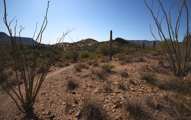
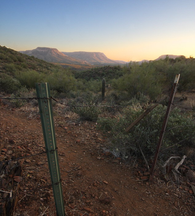
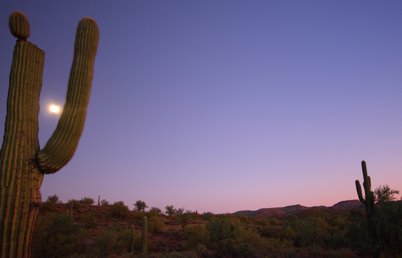
Come see the Agua Fria! by JoelHazelton  Overview OverviewThe Black Canyon Trail is a 62-mile trail that stretches through the Bradshaw Mountains' foothills from the Carefree Highway at the southern terminus to the Black Hills at the north end. Currently, as of October 2008, only the southern half of the trail is completed, and only one of the trailheads is complete with facilities and a parking lot, although 4 of the trailheads are currently signed and accessible. The trail is open to hikers, bikers, and equestrians- no motorized vehicles are allowed. This description will detail the section from the Table Mesa Road Trailhead, north, to the Little Pan Loop. This is the northern-most section of the trail that is currently completed. Hike From the parking area, the trail takes off in a northwestern direction on a small, single-track path. This is nice because nothing wider than a horse can fit on it, so none of the plethoras of off-road vehicles that frequent the area can use the trail. Very soon, you will reach the first signed trail junction. If you bear left, you will cross Table Mesa Road and make your way to the Boy Scout Loop, eventually reaching the Emery Henderson Trailhead. If you turn right, you will head towards the Little Pan Loop, which I will describe here.
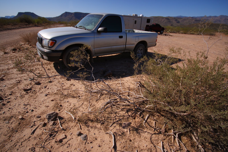
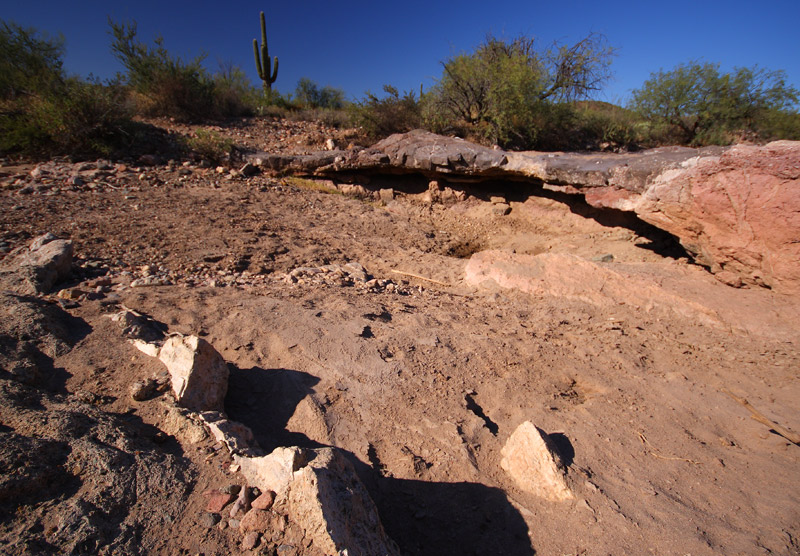
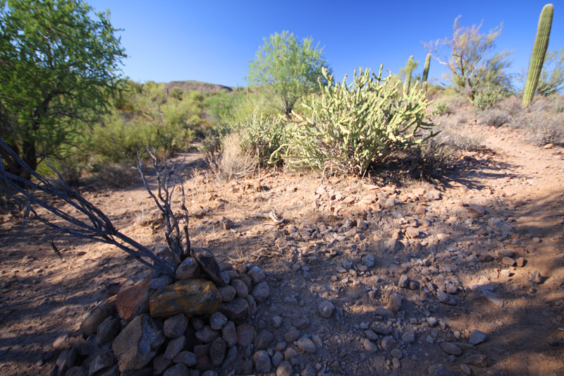
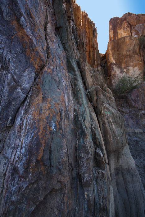
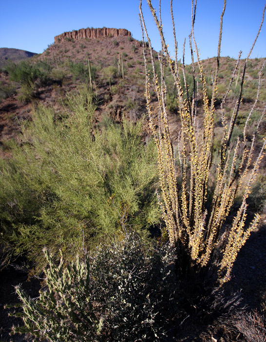
Around mile 1.73 you'll reach an unsigned trail junction. It is marked with a large cairn as of this writing, but I'm guessing they will erect a sign sometime soon. This is the beginning of the loop portion of the hike. I took the loop clockwise, which would be a left turn at this junction, so that is how I will describe it. Bear left at the cairn and follow the trail through some ravines until you reach the rim of the Agua Fria River, which is an impressive canyon. A large grove of cottonwoods on the west side of the river steals the show. Hike down a couple of long, lazy switchbacks and past a couple of "Black Canyon Trail" signs, and you reach the bed of the river at mile 2.25. Here is the first of the only 2 route-finding issues you may encounter on this hike: The trail dumps you out into the river bed but doesn't indicate where to go from here. When you peer across the wide canyon, you probably won't spot the continuation of the trail on the other side upon first glance. I ended up walking upstream to the first bend on this hike, looking for another trail sign. While the trail doesn't actually continue in this direction, the bed of the Agua Fria certainly is worth exploring, especially if there is water (which there wasn't on my trip). Make sure to check out the sheer cliffs that form the walls on the east side of the river. In order to continue on the trail, cross the river bed where the trail dumps you out and bear left once you reach the other side. In about a hundred feet, you'll spot the sign and the continuation of the trail at the base of a small cliff. Hike the switchbacks up the cliff and top out with a nice view peak 2025 to your right, which is an impressive butte. Before you know it, you'll cross the drainage to your right and hike along the base of this butte. Soon you'll pass this and start to work your way in and out of a series of washes along the base of 3,000 foot Williams Mesa, which looms to the northwest. At around mile 4.93, you'll reach a signed trail junction. This is the "top" of the loop. If you bear left, you can continue north to the Black Canyon City Trailhead (mighty tempting; I'm betting this would be the most interesting portion of the Black Canyon Trail). That will be another day, though... To complete the Little Pan Loop, take a right at this junction. This will drop you straight down to a dirt road where you take a right. In less than a mile, you'll be taking a sharp right off the road onto a jeep trail, which should take you most of the way back down to the Agua Fria, where you cross it for the second time during this hike. The second crossing of the Agua Fria is the next issue in route finding: Once you near the bed of the Agua Fria, the trail will stay on the sandy northern bank of the river for just a bit. It will soon reach a tall Black Canyon Trail sign to your left, slightly elevated above where you are hiking. There is a jeep track that takes off to the left, higher up on the bank, and straight ahead, another sandy trail dumps you into the riverbed. My belief (although this certainly is not confirmed) is that bearing left would eventually get you to the Little Pan Trailhead. The map on the Black Canyon Trail website indicates this. For this hike, drop into the river and immediately cross the wide, rocky riverbed. You will reach a large, trashed camping area. Take a left at a trail that takes off from this camping area, back towards the river, and you will reach two more Black Canyon Trail signs that are completely invisible from the opposite side of the river where the trail terminated. The signs direct you southeast over a lightly trodden, grassy path to another sign and a jeep track that switchbacks up the side of the canyon. Follow this path, and you're on the home stretch. The next two miles are steady climbing up a drainage that tops you out at around 2100 feet (the high point of the hike), at which point you drop back down and work your way back to the cairned junction. At this point, you've hiked about 8.27 miles and have the 1.73-mile hike back to the trailhead, making for a total distance of about 10 miles. All in all, this was a great lasso-loop hike. The elevation gain wasn't too much, but there were plenty of ups and downs and a moderate distance that made the hike well worth it. The biggest problem was the incessant sound of target shooting that didn't cease until it got dark, but my mp3 player and headphones were more than sufficient to drown that out. I passed two people on horses and one mountain biker the entire time. There are NO reliable water sources along this trail. The Agua Fria may be a river, but it's an Arizona river, and it's usually bone-dry. This trip was no exception. I encountered enough gigantic, gas-guzzling 4x4 trucks hauling ATVs to last me a lifetime on the drive in. I felt very out of place in my little Tacoma, and I swear I got at least a few "looks" (in high school, they called it "mad-dogging"). This is certainly off-roading, ATV, target shooting, and RV territory. Don't expect much peace and quiet unless you go on a weekday. I went on a 75 degree Sunday afternoon and didn't finish until it was dark. Enjoy! Gate Policy: If a gate is closed upon arrival, leave it closed after you go through. If it is open, leave it open. Leaving a closed gate open may put cattle in danger. Closing an open gate may cut them off from water. Please be respectful, leave gates as found. The exception is signage on the gate directing you otherwise. Check out the Official Route and Triplogs. Leave No Trace and +Add a Triplog after your hike to support this local community. | |||||||||||||||||||||||||||||||||||||||||||||||||||||||||||||||||||||||||||||||||||||||||||||||||||||||||||||||||||||||||||||||||||||||||||||||||||||||||||||||||||||||||||||||||||||


