Overview
This trail shares a trailhead with the Oaks and Willows Trail #3 in the Juniper Mountain Wilderness. A new portion of the trail connects to the Juniper Mesa Trail #20, allowing for a nice 6.5-mile loop hike when combined with Trails 3 and 20. The only problem is that the new portion of trail 100 is quite treacherous. It is very steep with a few switchbacks and many large rocks. Just imagine hiking on river rock as large as your boots. It is no fun climbing down this portion.
When hiking several trails on a single "hike", log it with a generic name that describes the hike. Then link the trails traveled, check out the example.
WARNING! Hiking and outdoor related sports can be dangerous. Be responsible and prepare for the trip. Study the area you are entering and plan accordingly. Dress for the current and unexpected weather changes. Take plenty of water. Never go alone. Make an itinerary with your plan(s), route(s), destination(s) and expected return time. Give your itinerary to trusted family and/or friends.
Only trailheads with six "amenities" have fees. Amenities are picnic tables, trash, toilet, parking, interpretive signing and security.
Directions
Road
Paved - Car Okay
To hike Access and trailhead location: Take the Williamson Valley Road north from Prescott. Stay on this road (FR 6) for 38 miles to the junction with FR 95. Turn west on FR 95 for about 1.5 miles to the Walnut Creek Station. From here travel west on FR 150 for about 6 miles to the trail.
 Route Editor


 Overview
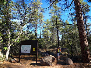


