username
X
password
register
for free!
help
 

Crest Trail - Silly Mtn, AZ

Guide 38 Triplogs  0 Topics
  2.5 of 5  
Fav
Wish
2
details
drive
no permit
forecast
route  
stats
photos
triplogs
topics
location
6 38 0
Statistics
tap row or icons for details
Difficulty 1.5 of 5
Distance One Way 0.7 miles
Trailhead Elevation 1,826 feet
Elevation Gain 338 feet
Kokopelli Seeds 1.83
feature photo
Photos Viewed All MineFollowing
Inaugural Calculation on Button Tap!
5  2023-02-02
Palo Verde Trail - Silly Mtn
Tortoise_Hiker
25  2020-02-20
Rice Peak - Pinal Co Hi Point - Silly Mtn
DixieFlyer
10  2015-12-29
Silly Mountain Trail System
outdoor_lover
7  2015-10-17
Silly 9L
chumley
7  2013-10-17
Silly Mountain Trail System
Stoic
11  2013-02-20
Silly Mountain Trail System
Mike_Fels
15  2011-12-08
Silly Mountain Trail System
tibber
6  2008-11-07 AZLOT69
Author
author avatar Guides 16,843
Routes 17,472
Photos 24
Trips 1 map ( 6 miles )
Age 28 Male Gender
Location HAZ, TrailDEX
Associated Areas
list map done
Phoenix Region
Historical Weather
Trailhead Forecast
Radar Map
Expand Map
Preferred Feb, Jan, Dec, Nov
Sun  6:03am - 6:46pm
Official Route & 1 Rt
 
9 Alternative


remove free decal offer

Guide Needed
Publish Full Detail Guide


Use +Add above to share photos and triplogs
Overview: This is part of the Silly Mountain Trail system. It goes right down the middle riding the crest.
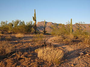
Happy

Trails!


  • Silly Mountain Trails
    area related
    Silly Mountain Trails


Check out the Official Route and Triplogs.
Leave No Trace and +Add a Triplog after your hike to support this local community.

One-Way Notice
This hike is listed as One-Way.

When hiking several trails on a single "hike", log it with a generic name that describes the hike. Then link the trails traveled, check out the example.
WARNING! Hiking and outdoor related sports can be dangerous. Be responsible and prepare for the trip. Study the area you are entering and plan accordingly. Dress for the current and unexpected weather changes. Take plenty of water. Never go alone. Make an itinerary with your plan(s), route(s), destination(s) and expected return time. Give your itinerary to trusted family and/or friends.

 Permit $$
None


 Directions
or
 Road
Paved - Car Okay

To hike
From Gold Canyon take Superstition Mountain Drive one mile north of Highway 60. Turn left on Hacienda Las Gavia Drive. One half mile to third street on the left, Turn left on Barragan. Take it to the end turn left on Tigre Del Mar Dr. and park on street at corner, which is the trailhead. Go up stairs and take the middle trail. At the next unmarked intersection bear right.
page created by AZLOT69 on Nov 07 2008 7:56 pm
 90+° 8am - 6pm kills
helpcorrectionissue

end of page marker