 Route Editor

| Guide | ♦ | 13 Triplogs | 0 Topics |
details | drive | no permit | forecast | 🔥 route |
stats |
photos | triplogs | topics | location |
| 110 | 13 | 0 |
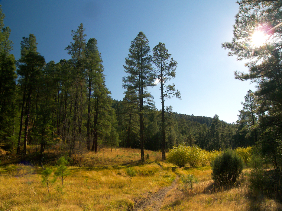
pinos altos, por supuesto by PrestonSands Hike: From the signed trailhead along highway 15, the Signal Peak Trail crosses a grassy cienega along Cherry Creek, then turns southeast to steadily climb a forested slope. The trail is a little indistinct at this point as it travels over exposed bedrock, but soon turns into a definite path.
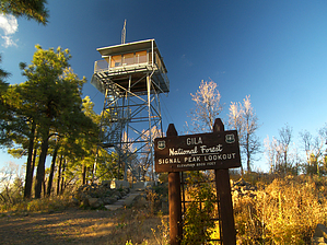
At the head of the ridge, the trail bends south to traverse the mountainside, before turning southeast again at 1.4 miles onto a gently sloping bench of open pine forest. The bench soon transitions to a mountain slope, and the trail renews its vigorous climb up the west side of Signal Peak. Small breaks among the massive ponderosa pines reveal the rolling green hills and valleys of the Pinos Altos range, now far below. As the trail nears the summit, switchbacks begin anew, and a short spur trail to a conveniently located ledge provides an ideal lunch spot with an outstanding view. Stunted trees and a gentler slope signal the proximity of the summit. Emerging from the Gambel oaks at mile 2.5, the fire lookout tower comes into view, and the trail comes to an end at the summit of Signal Peak. The best views are from the fire tower, where one can see most of southwestern New Mexico, including the Chihuahuan Desert to the south, and the Gila Wilderness to the north. From Signal Peak, one can return the way they came or continue east along Forest Road 154 to other connecting trails. Check out the Official Route and Triplogs. Leave No Trace and +Add a Triplog after your hike to support this local community. | |||||||||||||||||||||||||||||||||||||||||||||||||||||||||||||||||||||||||||||||||||||||||||||||||||||||||||


