username
X
password
register
for free!
help
  This is likely a great time to hike this trail!  Check out "Preferred" months below, keep in mind this is an estimate.
  🔥

Yeager Cyn Loop from FR321/FR9707S TH, AZ

Guide 1 Triplog  0 Topics
  2 of 5  
Fav
Wish
2
details
drive
no permit
forecast
🔥
route  
stats
photos
triplog
topics
location
8 1 0
Statistics
tap row or icons for details
Difficulty 1.5 of 5
Route Finding 2 of 5
Distance Round Trip 4.1 miles
Trailhead Elevation 7,343 feet
Elevation Gain 270 feet
Accumulated Gain 556 feet
Avg Time Round Trip 3-3.5 hrs
Kokopelli Seeds 6.88
 Interest Off-Trail Hiking & Seasonal Creek
unreported if dogs are allowed
editedit > ops > dogs to adjust
feature photo
Photos Viewed All MineFollowing
Inaugural Calculation on Button Tap!
8  2013-09-28 Grasshopper
Author
author avatar Guides 16,843
Routes 17,472
Photos 24
Trips 1 map ( 6 miles )
Age 28 Male Gender
Location HAZ, TrailDEX
Associated Areas
list map done
Payson Region
Historical Weather
Trailhead Forecast
Radar Map
Expand Map
Preferred May, Oct, Sep, Jun
Sun  6:00am - 6:47pm
Official Route
 
0 Alternative
 
Historic Fire Perimetersacres
🔥 2019 Hart Fire5k
🔥 2015 Rebel Fire2.4k
🔥 View (All) - over Official Route 🔥


remove free decal offer

  Likely In-Season!
Guide Needed
Publish Full Detail Guide


Use +Add above to share photos and triplogs
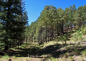
A pleasant, minor route finding, off trail, pioneer logging roads hike from Mogollon Rim FR321 TH Start, with initial hike start on "closed to vehicle traffic" logging roads FR9707S to FR9737Q paralleling upper rim top of middle Yeager Canyon then following GPS Route to connect with FR9722Y to later connect with open to vehicle traffic FR321 for loop back to TH Start.


    Check out the Official Route and Triplog.
    Leave No Trace and +Add a Triplog after your hike to support this local community.
    WARNING! Hiking and outdoor related sports can be dangerous. Be responsible and prepare for the trip. Study the area you are entering and plan accordingly. Dress for the current and unexpected weather changes. Take plenty of water. Never go alone. Make an itinerary with your plan(s), route(s), destination(s) and expected return time. Give your itinerary to trusted family and/or friends.

     Permit $$
    None


     Directions
    or
     Road
    High Clearance possible when dry

    To hike
    From the Phoenix area: Hwy 87 to north of Strawberry to Mogollon Rim top to "either" Rim Road FR300 (at MP281.1) to FR321 "or" Hwy 87 to north of Strawberry to Mogollon Rim top to Hwy 87 north of Clints Well to FR95 to FR96 (at East Clear Creek bridge crossing) to FR321 to "unmarked" park and TH Start at FR321/FR9707S. It is recommended to download and follow the "official" GPS Route (with included way point for Parking/TH Start) posted to this hike description.
    page created by Grasshopper on Oct 04 2013 10:18 pm
     90+° 8am - 6pm kills
    helpcorrectionissue

    end of page marker