|
tap row or icons for details
|
| Difficulty |
|
0.5 of 5 |
| Distance One Way |
|
2.7 miles |
| Trailhead Elevation |
|
164 feet |
| Elevation Gain |
|
100 feet |
| Accumulated Gain |
|
200 feet |
| Kokopelli Seeds |
|
3.37 |
| Interest Ruins & Historic | |
| | |
|
|
40 |
2016-04-15 | Bradshaws |
|
|
150 |
2013-10-25 |
San Francisco Tour - October 2013 |
Randal_Schulhaus |
|
|
| |
|
|
list |
map |
done |
Bay Area Region |
| | |
|
| |
|
|
Historical Weather |
| Trailhead Forecast | | |
|
 |
|
|
| Preferred Jul, Aug, Jun, Oct |
|
|
| | |
| |
Named Locations Coordinate Links
| |
|
| help future hikers |
| post a gps route now |
| | |
| |
|
|
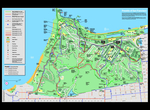
 A section of the California Coastal Trail that takes you from the Golden Gate Bridge visitor center above Fort Point to Baker Beach. The trail takes you above the bluffs and connects many of the old batteries dotting this strategic high grounds of the Presidio. I understand that many sections have been closed due to storm erosion, but in October 2013 signs of recent reconstruction have led to its reopening. Check out => http://www.presidio.gov/explore/trails/Pages/california-coastal-trail.aspx#.Um73GzK9KSN for more information.
One-Way NoticeThis hike is listed as One-Way. When hiking several trails on a single "hike", log it with a generic name that describes the hike. Then link the trails traveled, check out the example. |
 Route Editor


