Route Editor

| Guide | ♦ | 13 Triplogs | 0 Topics |
details | drive | no permit | forecast | 🔥 route |
stats |
photos | triplogs | topics | location |
| 231 | 13 | 0 |
Canyons are inherently risky. Flash floods occur without notice on sunny days. Technical skills & surrounding topography knowledge required yet does not eliminate risk.
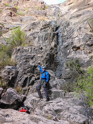
2nd Best Technical Canyon in the Supes by azmike  Overview OverviewA class 3BIII technical canyon loop hike in the Superstition Wilderness just below Superstition Peak. The approach to Ermahgerd Canyon starts at the Hieroglyphics trailhead in Gold Canyon, AZ, on a well-maintained trail for one mile until veering off-trail for a steep and rugged climb to just below the hoodoos of Superstition Peak. Ermahgerd Canyon is a significant drainage directly south of Superstition Peak one-half mile. There are two entry rappels into Ermahgerd Canyon: 215 ft and 250 ft. Down canyon, there are 4 more rappels where you will encounter pools of water and a final rappel of 270 ft. before exiting the canyon and picking up the Lost Goldmine trail and a 1.75-mile hike back to the Hieroglyphics trailhead. This is arguably the second-best technical canyon in the Superstition Wilderness with a strenuous climb on approach, but well worth it. Warning Ermahgerd Canyon is a technical canyon requiring rappelling and down climbing skills. Required gear includes a climbing helmet, harness, carabiners, descender, ascender, ropes, webbing, rap rings, gloves, and canyoneering shoes with good traction. This canyon can be done with a 300-foot rope, two 200 ft ropes, 50 feet of webbing, and 5 rap rings. Flash flooding is possible following the rains, so canyoneers must monitor the weather and exercise caution before dropping into this canyon. There are two big rappels in this canyon requiring a 300 ft. rope, so canyoneers should be comfortable rappelling longer distances. Although this canyon contains water, the pools could be easily crossed by wading through them. Only in colder weather would wetsuits be required.
From the Hieroglyphics trailhead, start hiking on the Hieroglyphics trail for approximately 1.1 miles, where you will leave the trail and start climbing up the steep grade at (33.40473 -111.42041). No cairns mark the point where you leave the trail. The off-trail hiking begins about 0.45 miles before the Hieroglyphics Spring further up the trail. Continue to climb in a northeasterly direction with a major drainage to your left. Do not enter the drainage, but hike around the top of it until you see a cliff wall to the north of the drainage (33.40804 -111.41498). Continue hiking in an easterly direction for one mile until you drop down to the entrance of Ermahgerd Canyon. You'll pass another major canyon before reaching Ermahgerd. Ermahgerd is exactly one-half mile due south of Superstition Peak. There is an east fork (N33.40497 -111.39984) and a west fork (33.40510 -111.40183) for Ermahgerd Canyon separated by less than an eighth of a mile. Ermahgerd can be rappelled into from the east fork or the west fork. Rap1 - East Fork The east fork first rappel is a 215 ft. partial free hang from anchor at (33.40432 -111.39951). The pull cord should be slung over the large rock in front of the anchor to avoid a stuck rope situation. Rap1 - West Fork The west fork first-rappel can be found at the end of a narrow drainage on the northwest side of the canyon (33.40510 -111.40183). You'll encounter some down climbs and bushwhacking as you make your way down the drainage. The first rappel is a 250 ft. rappel down a seasonal waterfall (33.40407 -111.40183) on a BFR several feet back from the drop. The rappel starts down a narrow chute before opening up. This is a pretty cool rappel, especially when the water is flowing. You'll be on the wall the entire time with no free hang. The pull location is best accomplished as far RDC as you can get. Rap2 The second rappel is a short distance from the first rappel and is an 85 ft. rappel anchored from a rock. Rap3 (optional) The third rappel is 15 ft. into a pool of water; however, it can be downclimbed on LDC. Rap4 The fourth rappel is a 130 ft. double drop rappel from a pretty bomber knot choke. The first drop is into a waist-deep pool of water. The rappel picks up around the corner and to your right. The second drop is straight down a slick wall into another waist-deep pool of water. Rap5 The final rappel is 270 ft. from a solid tree in the middle of the watercourse about 12 ft back from the edge of the drop. At this point, the canyon is pretty wide open, and the drop is slightly angled with several shelves to stop on if needed. The Exit After completing the fifth and final rappel, gear down and start hiking down canyon. As the canyon opens up, head due south, and you will encounter a cairned route for about 0.75 miles to the Lost Goldmine trail, which runs east-west. Go west on this well-maintained trail for approximately 1.75 miles until you reach the Hieroglyphics trailhead and your vehicle. Check out the Official Route and Triplogs. Leave No Trace and +Add a Triplog after your canyon trip to support this local community. | |||||||||||||||||||||||||||||||||||||||||||||||||||||||||||||||||||||||||||||||||||||||||||||||||||||||||||||||||||||||||||||||||||||||||||||||||||||||||||||||||||||||||||||||||||||||||||||||||||||||||||||||||||||