username
X
password
register
for free!
help
 

Judith Tunell Interpretive Trail - South Mtn, AZ

Guide 30 Triplogs  0 Topics
  1.5 of 5  
Fav
Wish
0
details
drive
no permit
forecast
route  
stats
photos
triplogs
topics
location
57 30 0
Statistics
tap row or icons for details
Difficulty 0.5 of 5
Distance Round Trip 0.5 miles
Trailhead Elevation 1,371 feet
Elevation Gain 10 feet
Accumulated Gain 25 feet
Kokopelli Seeds 0.63
 Dogs not allowed
feature photo
Photos Viewed All MineFollowing
Inaugural Calculation on Button Tap!
8  2025-08-10
Telegraph - Bursera Holbert Lasso Loop
joebartels
11  2025-07-28 mt98dew
18  2023-03-20 Tortoise_Hiker
8  2023-03-04
Goat Hill Loop via Pyramid / Bursera
johnlp
3  2020-03-22
Biaaz Rwr 2020 Diy
cellersick
1  2017-02-14 Tortoise_Hiker
1  2016-04-23
Holbert - National - Kiwanis - Lomitas - Box
afrankie
15  2014-01-05
SoMo Park Circle Route - 1934 Master Plan
Randal_Schulhaus
Author
author avatar Guides 16,843
Routes 17,472
Photos 24
Trips 1 map ( 6 miles )
Age 28 Male Gender
Location HAZ, TrailDEX
Associated Areas
list map done
Phoenix Region
Historical Weather
Trailhead Forecast
Radar Map
Expand Map
Preferred Feb, Jan, Dec, Nov
Sun  6:05am - 6:48pm
Official Route & 2 Rts
 
1 Alternative


remove free decal offer

Guide Needed
Publish Full Detail Guide


Use +Add above to share photos and triplogs
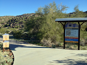
From the South Mountain Environmental Education Center (aka SMEEC) the interpretive trail heads westward. Signage will describe the local flora and fauna as well as some local human history. Loop includes a cluster of petroglyphs.


  • 2022 South Mountain Park
    area related
    2022 South Mountain Park


Check out the Official Route and Triplogs.
Leave No Trace and +Add a Triplog after your hike to support this local community.
WARNING! Hiking and outdoor related sports can be dangerous. Be responsible and prepare for the trip. Study the area you are entering and plan accordingly. Dress for the current and unexpected weather changes. Take plenty of water. Never go alone. Make an itinerary with your plan(s), route(s), destination(s) and expected return time. Give your itinerary to trusted family and/or friends.

 Permit $$
None


 Directions
or
 Road
Paved - Car Okay

To hike
page created by Randal_Schulhauser on Jan 05 2014 8:03 pm
 90+° 8am - 6pm kills
helpcorrectionissue

end of page marker