username
X
password
register
for free!
help
 

La Jolla Coast Walk Trail, CA

Guide 3 Triplogs  0 Topics
  5 of 5  
Fav
Wish
0
details
drive
no permit
forecast
route  
stats
photos
triplogs
topics
location
0 3 0
Statistics
tap row or icons for details
Difficulty 1 of 5
Distance One Way 0.3 miles
Trailhead Elevation 43 feet
Elevation Gain 68 feet
Accumulated Gain 68 feet
Kokopelli Seeds 0.53
 Interest Historic
feature photo
Photos Viewed All MineFollowing
Inaugural Calculation on Button Tap!
35  2014-11-23
La Jolla CA - Nov2014
Randal_Schulhaus
65  2014-03-22
La Jolla CA 3-Day Weekend
Randal_Schulhaus
Author
author avatar Guides 16,843
Routes 17,472
Photos 24
Trips 1 map ( 6 miles )
Age 28 Male Gender
Location HAZ, TrailDEX
Historical Weather
Trailhead Forecast
Radar Map
Expand Map
Preferred May, Jun, Jul, Aug
Sun  5:25am - 6:10pm
Official Route
 
0 Alternative


remove free decal offer

Guide Needed
Publish Full Detail Guide


Use +Add above to share photos and triplogs
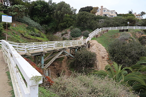
From the famous "Cave Store" near the corner of Prospect Street and Coast Boulevard, the La Jolla Coast Trail is a dirt path that hugs the high bluffs ending at the corner of Torrey Pines Road and Coast Walk.


    Check out the Official Route and Triplogs.
    Leave No Trace and +Add a Triplog after your walk/tour to support this local community.
    WARNING! Hiking and outdoor related sports can be dangerous. Be responsible and prepare for the trip. Study the area you are entering and plan accordingly. Dress for the current and unexpected weather changes. Take plenty of water. Never go alone. Make an itinerary with your plan(s), route(s), destination(s) and expected return time. Give your itinerary to trusted family and/or friends.

     Permit $$
    no fees or permits reported

    if incorrect tell us about it


     Directions
    or
     Road
    Paved - Car Okay

    To walk/tour
    page created by Randal_Schulhauser on Mar 23 2014 1:54 pm
     90+° 8am - 6pm kills
    helpcorrectionissue

    end of page marker