| Guide | ♦ | 4 Triplogs | 0 Topics |
details | drive | permit | forecast | map |
stats |
photos | triplogs | topics | location |
| 45 | 4 | 0 |
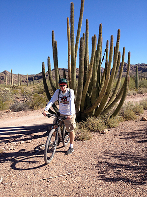
 Although many people breeze through Organ Pipe Cactus National Monument (ORPI) on their way to Mexico, one of the most popular viewing options is to take a scenic drive along Ajo Mountain Drive. Traveling this scenic loop drive on bicycle takes it to a whole new level of appreciation for the unique geology and flora that resides in ORPI. Although many people breeze through Organ Pipe Cactus National Monument (ORPI) on their way to Mexico, one of the most popular viewing options is to take a scenic drive along Ajo Mountain Drive. Traveling this scenic loop drive on bicycle takes it to a whole new level of appreciation for the unique geology and flora that resides in ORPI. Check out the Triplogs. Leave No Trace and +Add a Triplog after your mountain bike ride to support this local community. | |||||||||||||||||||||||||||||||||||||||||||||||||||||||||||||
 Route Editor


