username
X
password
register
for free!
help
 This is likely a great time to hike this trail!  Check out "Preferred" months below, keep in mind this is an estimate. 
  🔥

Peak 6260 - Mazatzal Mountains, AZ

Guide 2 Triplogs  0 Topics
  0 of 5  
Fav
Wish
1
details
drive
no permit
forecast
🔥
route  
stats
photos
triplogs
topics
location
18 2 0
Statistics
tap row or icons for details
Difficulty 1 of 5
Distance Round Trip 1 mile
Trailhead Elevation 6,013 feet
Elevation Gain 236 feet
Accumulated Gain 236 feet
Kokopelli Seeds 2.18
 Interest Off-Trail Hiking & Peak
unreported if dogs are allowed
editedit > ops > dogs to adjust
feature photo
Photos Viewed All MineFollowing
3  2015-08-01 BEEBEE
15  2014-04-23 BEEBEE
Author
author avatar Guides 16,843
Routes 17,472
Photos 24
Trips 1 map ( 6 miles )
Age 28 Male Gender
Location HAZ, TrailDEX
Associated Areas
list map done
Phoenix Region
Historical Weather
Trailhead Forecast
Radar Map
Expand Map
Preferred May, Oct, Apr, Sep
Sun  6:02am - 6:46pm
Official Route
 
0 Alternative
 
Historic Fire Perimetersacres
🔥 2020 Bush Fire193.5k
🔥 2005 Edge Complex Fire72.3k
🔥 1996 Lone Fire65.1k
🔥 1975 Bob Fire12.9k
🔥 View (All) - over Official Route 🔥


remove free decal offer

 Likely In-Season! 
Guide Needed
Publish Full Detail Guide


Use +Add above to share photos and triplogs
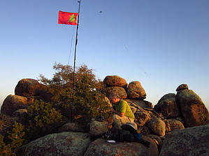
Off trail peak north of Browns peak with great views of the Four peaks, Mt Ord, Mazatzals, Roosevelt Lake and the Sierra Ancha's. This is also an 8 point summit for Summits on the Air W7A/GI-047 Peak 6260.


    Check out the Official Route and Triplogs.
    Leave No Trace and +Add a Triplog after your hike to support this local community.
    WARNING! Hiking and outdoor related sports can be dangerous. Be responsible and prepare for the trip. Study the area you are entering and plan accordingly. Dress for the current and unexpected weather changes. Take plenty of water. Never go alone. Make an itinerary with your plan(s), route(s), destination(s) and expected return time. Give your itinerary to trusted family and/or friends.

     Permit $$
    no fees or permits reported

    if incorrect tell us about it


     Directions
    or
     Road
    FR / Jeep Road - Car possible when dry

    To hike
    From 188 take the El Orso Road continue Right past the turn for Pigeon Spring Road. Then after approx. 1.08 miles take FR 422 for about 1.86 miles you will come to a sharp bend in a drainage with in incline park here this is the location I started the off trail hike to the peak
    page created by BEEBEE on Apr 24 2014 10:22 am
     90+° 8am - 6pm kills
    helpcorrectionissue

    end of page marker