username
X
password
register
for free!
help
   This is likely a great time to hike this trail!  Check out "Preferred" months below, keep in mind this is an estimate.
 

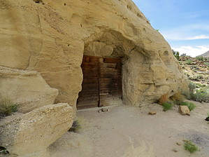
Batty Pass Caves, UT

Guide 1 Triplog  0 Topics
  3 of 5  
Fav
Wish
0
details
drive
no permit
forecast
map
stats
photos
triplog
topics
location
6 1 0
Statistics
tap row or icons for details
Difficulty 1 of 5
Distance Round Trip 2 miles
Trailhead Elevation 5,127 feet
Elevation Gain 200 feet
Accumulated Gain 260 feet
Kokopelli Seeds 3.3
feature photo
Photos Viewed All MineFollowing
6  2014-06-16 AZLOT69
Author
author avatar Guides 16,843
Routes 17,472
Photos 24
Trips 1 map ( 6 miles )
Age 28 Male Gender
Location HAZ, TrailDEX
Associated Areas
list map done
Southwest Region
Historical Weather
Trailhead Forecast
Expand Map
Preferred Oct, May, Apr, Sep
Sun  5:59am - 6:48pm
0 Route
 
0 Alternative


remove free decal offer

   Likely In-Season!
Guide Needed
Publish Full Detail Guide


Use +Add above to share photos and triplogs
In the 1950's, 1960's there were miners in the area looking for Uranium. Two brothers from Germany made living quarters out of the mountain. There are three man made caves. One appears to have been living quarters. One appears to have been a workshop. The third maybe a utility area or garage. Interesting to check it out and the surrounding foothills.


    Check out the Triplog.
    Leave No Trace and +Add a Triplog after your hike to support this local community.
    WARNING! Hiking and outdoor related sports can be dangerous. Be responsible and prepare for the trip. Study the area you are entering and plan accordingly. Dress for the current and unexpected weather changes. Take plenty of water. Never go alone. Make an itinerary with your plan(s), route(s), destination(s) and expected return time. Give your itinerary to trusted family and/or friends.

     Permit $$
    None


     Directions
    or
     Road
    High Clearance possible when dry

    To hike
    Hole-in-the-Rock Road south 26 miles from Escalante. At Dry Fork Road turn Right. Go two miles and watch for rusted out car on left. It gets to be high clearance so you may have to park and hike. There are many turnoffs. Stay with the most used main trail.
    page created by AZLOT69 on Jun 16 2014 8:35 pm
     90+° 8am - 6pm kills
    helpcorrectionissue

    end of page marker