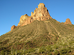
Overview
This short, easy, and partly "off-trail" hike starts at the Byous Butte primitive campsite area TH(see driving directions below).
You will start hiking at the described rock cairn TH marker and proceed back out of the campsite area onto FR172. Turn Left(NE)on FR172 and hike up FR172 and then downhill on FR172 to a wash drainage entrance (Note: left turn here, not right turn) at the low spot in the road at GPS Waypoints N33 22.037 W111 12.019 (this is approximately 0.41 mi on FR172 from your beginning TH Start location).
As noted, you will turn Left into this wash drainage and continue hiking up this drainage to a total of 0.81 mi arriving at what I have named obvious & perennial "Hidden Springs" at GPS Waypoints N33 22.219 W111 12.251; This perennial "Hidden Springs" provides water for the local wildlife during the hot and drier months of the year.
WARNING! Hiking and outdoor related sports can be dangerous. Be responsible and prepare for the trip. Study the area you are entering and plan accordingly. Dress for the current and unexpected weather changes. Take plenty of water. Never go alone. Make an itinerary with your plan(s), route(s), destination(s) and expected return time. Give your itinerary to trusted family and/or friends.
Permit $$
None
Directions
Road
High Clearance possible when dry
To hike From the Phoenix area: Take US 60 east out of Apache Junction. A couple of miles past Florence Junction at MP214.2, turn north onto Queen Valley Road and drive for 1.8 miles. Turn right onto FR357 (Hewitt Station Road) and drive for 3.0 miles to signed FR172. Turn left onto FR172 and drive for 6.0 miles to "easy to miss" high clearance primitive campsite entrance road(left turn) at GPS Waypoints N33 21.892 W111 12.277
Continue driving in this rutted campsite entrance road for approx 100 yards to the first turn-in campsite entrance area on your left side; Park in here and walk to the top of the wash entrance area at GPS Waypoints N33 21.930 W111 12.293, and you will see a ROCK CAIRN at this location which marks the TH START of this Hike.
page created by Grasshopper on Jan 13 2009 3:24 pm
 Route Editor

 Overview