|
tap row or icons for details
|
| Difficulty |
|
1 of 5 |
| Distance One Way |
|
18 miles |
| Trailhead Elevation |
|
10 feet |
| Elevation Gain |
|
25 feet |
| Accumulated Gain |
|
50 feet |
| Kokopelli Seeds |
|
18.17 |
| Interest Historic | |
| | |
|
|
9 |
2022-11-04 | Lucyan |
|
|
31 |
2022-02-12 | Lucyan |
|
|
50 |
2016-02-12 | Lucyan |
|
|
208 |
2015-08-23 |
Big Sur Coastline CA Redux - August 2015 |
Randal_Schulhaus |
|
|
|
151 |
2014-08-18 |
Big Sur Coastline - August 2014 |
Randal_Schulhaus |
|
|
| |
|
|
|
list |
map |
done |
Central Coast Region |
| | |
|
| |
|
|
Historical Weather |
| Trailhead Forecast | | |
|
 |
|
|
| Preferred Aug, Sep, Jul, Oct |
|
|
| | |
| |
Named Locations Coordinate Links
| |
|
| help future hikers |
| post a gps route now |
| | |
| |
|
|
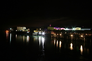
 The 18 mile trail runs over the old Southern Pacific railroad tracks that serviced Cannery Row during the famed sardine era. This paved path stretches 18 miles from Castroville in the north to Pacific Grove in the south accommodating walkers, hikers, and bikers. From Fisherman's Wharf beside Monterey Municipal Beach, head north along the path towards the dunes. Or head southwest towards the famed Monterey Aquarium on Cannery Row and Pebble Beach beyond. The trail boasts scenic vistas and wildlife viewing, including harbor seals, sea otters, sea lions, birds and sometimes even whales!
One-Way NoticeThis hike is listed as One-Way. When hiking several trails on a single "hike", log it with a generic name that describes the hike. Then link the trails traveled, check out the example. |
 Route Editor


