 Route Editor

| Guide | ♦ | 34 Triplogs | 0 Topics |
details | drive | permit | forecast | route |
stats |
photos | triplogs | topics | location |
| 0 | 34 | 0 |
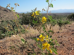
 Overview OverviewBoulder Trail is a short connector trail between the Marcus Landslide and the rest of the McDowell Mountain Regional Park. Hike Boulder Trail is a relatively flat and easy stroll from the Marcus Landslide into the interior of the MMRP. There is official signage marking its endpoints as of this writing. If you're heading east from the Landslide, you'll eventually connect with the Pemberton Trail, where you'll have to decide whether to head north or south. Views to the east are sweeping and of the Superstition Mountains, including clear views of the Four Peaks and Weaver's Needle. You can also see Mt. Ord. Views to the west are of the McDowell Mountains and East End Peak, particularly in addition to the landslide. This network of trails, in general, is more popular with mountain bikers than with hikers, which you'll understand once you see how flat the terrain is. The route is reasonably easy to follow. If you attempt this in warm weather, bring sufficient water for desert hiking.
Check out the Official Route and Triplogs. Leave No Trace and +Add a Triplog after your hike to support this local community. One-Way Notice This hike is listed as One-Way. When hiking several trails on a single "hike", log it with a generic name that describes the hike. Then link the trails traveled, check out the example. | ||||||||||||||||||||||||||||||||||||||||||||||||||||||||||||||||||||||||||||||||||||||||||||||||||||||||||||||||||||||||||||||||||||||||||||||||||||||||||||||||||||||||||||||||||||||||||||


