|
tap row or icons for details
|
| Difficulty |
|
1.5 of 5 |
| Distance One Way |
|
1.1 miles |
| Trailhead Elevation |
|
248 feet |
| Elevation Gain |
|
280 feet |
| Accumulated Gain |
|
305 feet |
| Kokopelli Seeds |
|
2.12 |
| Interest Ruins, Historic & Perennial Creek | | Dogs not allowed |
| | |
|
|
208 |
2015-08-23 |
Big Sur Coastline CA Redux - August 2015 |
Randal_Schulhaus |
|
|
|
151 |
2014-08-18 |
Big Sur Coastline - August 2014 |
Randal_Schulhaus |
|
|
| |
|
|
|
list |
map |
done |
Central Coast Region |
| | |
|
| |
|
|
Historical Weather |
| Trailhead Forecast | | |
|
 |
|
|
| Preferred Apr, Nov, Mar, Feb |
|
|
| | |
| |
Named Locations Coordinate Links
| |
|
| help future hikers |
| post a gps route now |
| | |
| |
|
|
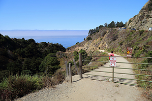
 The trail follows an access road down to a tunnel that passes through to Partington Cove. In the 1800's this was used to transport tanbark onto schooners anchored just offshore in Partington Cove. Remains of the loading mechanism can be found today if you look closely. Tanbark Trail to Tin House Trail starts on the other side of Hwy 1 trail head. One-Way NoticeThis hike is listed as One-Way. When hiking several trails on a single "hike", log it with a generic name that describes the hike. Then link the trails traveled, check out the example. |
 Route Editor


