username
X
password
register
for free!
help
 This is likely a great time to hike this trail!  Check out "Preferred" months below, keep in mind this is an estimate.
 

Elder Canyon, AZ

Guide 3 Triplogs  0 Topics
  0 of 5  
Fav
Wish
2
details
drive
no permit
forecast
map
stats
photos
triplogs
topics
location
15 3 0
Canyons are inherently risky. Flash floods occur without notice on sunny days. Technical skills & surrounding topography knowledge required yet does not eliminate risk.
Canyoneering
Consensus
View 1
Grade3
WaterA
Risk
TimeII
Statistics
tap row or icons for details
Distance Round Trip 6 miles
Trailhead Elevation 7,578 feet
Elevation Gain 2,400 feet
Kokopelli Seeds 18
 Interest Off-Trail Hiking & Seasonal Creek
unreported if dogs are allowed
editedit > ops > dogs to adjust
feature photo
Photos Viewed All MineFollowing
2  2017-04-01 MountainMatt
13  2014-08-23 azflyguy
Author
author avatar Guides 16,843
Routes 17,472
Photos 24
Trips 1 map ( 6 miles )
Age 28 Male Gender
Location HAZ, TrailDEX
Historical Weather
Trailhead Forecast
Expand Map
Preferred May, Jun, Aug, Sep
Sun  6:02am - 6:48pm
1 Route
 
0 Alternative


remove free decal offer

 Likely In-Season!
Guide Needed
Publish Full Detail Guide


Use +Add above to share photos and triplogs
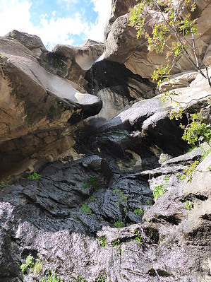
Short but scenic canyon just outside of Flagstaff with one 105' rappel.

Happy

Trails!


    Check out the Triplogs.
    Leave No Trace and +Add a Triplog after your canyon trip to support this local community.
    WARNING! Hiking and outdoor related sports can be dangerous. Be responsible and prepare for the trip. Study the area you are entering and plan accordingly. Dress for the current and unexpected weather changes. Take plenty of water. Never go alone. Make an itinerary with your plan(s), route(s), destination(s) and expected return time. Give your itinerary to trusted family and/or friends.

     Permit $$
    no fees or permits reported

    if incorrect tell us about it


     Directions
    or
     Road
    Paved - Car Okay

    To canyon trip
    Follow Santa Fe Ave past the Flagstaff Mall and the Peaks Ranger District Office to the trailhead parking lot just off the north side of the street.

    Go East on Highway 89. At 5.2 miles, just beyond Flagstaff Mall,(MP 419.5) you will see sign for "Mt Elden Trailhead" and a paved driveway to your left into a parking lot bounded by pole fence.

    This is a popular trail, so parking may be limited. Go through 2 maze-type gates and you will be headed right upto Mt.Elden
    page created by azflyguy on Aug 25 2014 7:56 pm
     90+° 8am - 6pm kills
    helpcorrectionissue

    end of page marker