Route Editor

| Guide | ♦ | 5 Triplogs | 0 Topics |
details | drive | no permit | forecast | route |
stats |
photos | triplogs | topics | location |
| 105 | 5 | 0 |
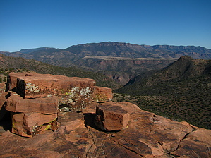
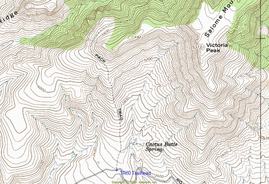
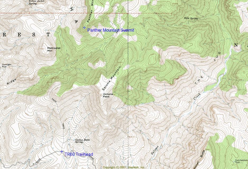
Room With A View by ssk44   Overview OverviewThe Cactus Butte Trail 60 is a remote backcountry hike, located within the Tonto National Forest in the Sierra Ancha Mountains north of Roosevelt Lake. This hike is all about big and vast views throughout the entire trip. The trail follows the western boundary of the Salome Wilderness, yet never actually enters the wilderness. TR60 is a very old pack trail decommissioned from the Tonto National Forests list of maintained hiking routes many years ago. However, the sign at the trailhead remains. Along this route, you will find a variety of high desert vegetation, mainly consisting of juniper/cedar and oak. Along the bottom of Methodist Creek, the canyon that the trail follows was a long stand of healthy cottonwood trees. Hike The hike as posted is from the trailhead to the southwestern point of Panther Mountain. TR60 technically goes about one mile northeast from the upper ridge towards Chubb Mountain and then turns into a rugged jeep route from there. This trail is in surprisingly good condition considering how old and lightly used the route is. On the south side of the road accessing the trailhead is a large parking area. The trail begins as a short jeep route heading to Cactus Butte Spring. Just before the jeep route leads down a hill towards the spring, you will see a moderately sized cairn. The first mile of this hike involves a big 1100' vertical climb to a ridgeline overlook of Methodist Creek. To my surprise, this trail was very well marked by well-placed moderate to large cairns throughout most segments of the route. The first quarter-mile of the hike is probably the vaguest due to the route following the crest of a broad rounded grassy ridge.
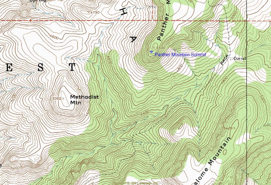
Final Segment: From here, things get a little ugly. The first thing you need to do is get the whole "trail thing" out of your head. The trail from this point is gone due to very little use and a century of erosion. What you are looking at is a rugged 3/4 mile, 640' vertical climb. Pause for a few minutes to study the terrain, commit to a game plan, and go for it. All you are doing is following a ridge straight north to the upper main ridgeline that leads either southwest to Panther Mountain or northeast to Chubb Mountain. Just before the top, you will encounter a line of boulders and small bluffs that can be navigated with caution. After you reach the top, things get easier. Panther Mountain Segment: You will now be leaving TR60 and will be heading southwest up a gradual hill to the summit and outer point of Panther Mountain (Lat. 33 degrees/48'/30.19"/N & Long. 111 degrees/8'/21.18"/W). The upper ridge heading towards Panther Mountain is rather nasty walking with deep grass hiding sharp cantaloupe size rocks and numerous small cacti. The cactus hides in the grass like a serpent waiting to strike, so you will want to keep a sharp eye looking towards the ground. Summary This is the epitome of a true backcountry hike with killer views, rugged terrain, and solitude. The main attraction on this hike is the vast 360-degree views of the surrounding area. Greenback Peak is to the northeast, the Mazatzal Mountains to the northwest, Four Peaks to the southwest, Roosevelt Lake, and the Superstition Mountains to the south, Armer Mountain and Thompson Mesa to the east. If you have an appreciation for the Sierra Ancha and love remote, rugged hikes, this trip will not disappoint. Count on having it all to yourself if you go. Gate Policy: If a gate is closed upon arrival, leave it closed after you go through. If it is open, leave it open. Leaving a closed gate open may put cattle in danger. Closing an open gate may cut them off from water. Please be respectful, leave gates as found. The exception is signage on the gate directing you otherwise.
Check out the Official Route and Triplogs. Leave No Trace and +Add a Triplog after your hike to support this local community. | ||||||||||||||||||||||||||||||||||||||||||||||||||||||||||||||||||||||||||||||||||||||||||||