Route Editor

| Guide | ♦ | 11 Triplogs | 0 Topics |
details | drive | no permit | forecast | 🔥 route |
stats |
photos | triplogs | topics | location |
| 314 | 11 | 0 |
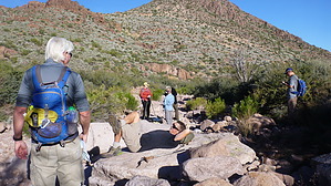
Mostly Off Trail - Well worth it by philnewell  Overview: This mostly off-trail loop hike will give you fantastic views of the Superstition Wilderness, Fours Peaks and a peek of Weavers Needle, a breathtaking drop-off at Massacre Grounds, and beautiful water features if you are lucky enough to catch this hike a day or two after a major storm! Overview: This mostly off-trail loop hike will give you fantastic views of the Superstition Wilderness, Fours Peaks and a peek of Weavers Needle, a breathtaking drop-off at Massacre Grounds, and beautiful water features if you are lucky enough to catch this hike a day or two after a major storm!Hike: The hike follows the Dutchman Trail from First Water trailhead for half a mile until you reach the first wash crossing the trail. Turn right (SW) and head up the wash. A mile and a quarter later, you will see the escarpment of Massacre Grounds. Head directly off-trail towards the right-hand end, and you will pick up the Massacre Grounds Trail. Follow this well-trodden trail to the Massacre Grounds, which is a lovely spot to take a break and take in the scenery. Keeping to the south side of the escarpment, you will see Massacre Falls, which may be flowing if it has stormed recently.
Now we try to contour over open desert through various sharp vegetation, try to stay up high as there is less vegetation. There are a few small hoodoo's that are interesting to visit. Eventually, the terrain funnels you down into a small stream until you ultimately reach First Water creek. You will know when you reach it as it is a big wash as it enters the canyon. Don't get suckered into the low saddle about half a mile before Fist Water. It looks like a short cut, but trust me when I say it is no cakewalk! I say this from experience. Follow First Water down through the beautiful slick rock, small canyons, and a few pools. If it has recently rained hard, you will be enriched with the cascading water through this creek, still very passable with water just a little more work. First Water ultimately connects with the Dutchman Trail for a nice leisurely walk back to First Water Trailhead. First Water is one of my favorite hikes in the Sups. Combine it with the views from Massacre Grounds and no crowds as it is off-trail, and you have the perfect hike. If a winter storm comes through Phoenix, be sure to head out within a couple of days to get the max water effect, you will not be sorry. Check out the Official Route and Triplogs. Leave No Trace and +Add a Triplog after your hike to support this local community. | ||||||||||||||||||||||||||||||||||||||||||||||||||||||||||||||||||||||||||||||||||||||||||||||||||||||||||||||||||||||||||||||||||||||||||||||||||||||||||||||||||||||||||||||||||||||||||||||||||||||||