username
X
password
register
for free!
help


Caballo Trail - MSP, AZ

Guide 17 Triplogs  0 Topics
  1.8 of 5  
Fav
Wish
0
details
drive
no permit
forecast
route  
stats
photos
triplogs
topics
location
7 17 0
Statistics
tap row or icons for details
Difficulty 0.5 of 5
Distance One Way 0.4 miles
Trailhead Elevation 2,741 feet
Accumulated Gain 52 feet
Kokopelli Seeds 0.57
feature photo
Photos Viewed All MineFollowing
Inaugural Calculation on Button Tap!
4  2024-02-07
Sven Towers 1-3 and MSP 38 of 39
pseudalpine
5  2023-06-10
Rock Knob Loop - MSP
BiFrost
25  2019-12-11
Gooseneck Trail - MSPC
Yoder
14  2018-11-09
Hog Heaven Extended Loop
KBKB
6  2018-07-27
Hog Heaven Loop Plus
KBKB
3  2018-07-04
Lost Wall Loop plus - MSP
KBKB
11  2018-02-16
Lost Wall Loop - McDowell Mountains
KBKB
18  2017-12-16
Marcus Landslide Clover Loop
tibber
Page 1,  2
Author
author avatar Guides 16,843
Routes 17,472
Photos 24
Trips 1 map ( 6 miles )
Age 28 Male Gender
Location HAZ, TrailDEX
Associated Areas
list map done
Phoenix Region
Historical Weather
Trailhead Forecast
Radar Map
Expand Map
Preferred Mar, Feb, Nov, Jan
Sun  6:04am - 6:48pm
Official Route & 1 Rt
 
3 Alternative


remove free decal offer

 
Guide Needed
Publish Full Detail Guide


Use +Add above to share photos and triplogs
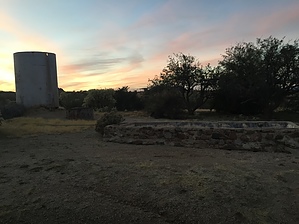
Caballo Trail begins at the Equestrian area at Tom's Thumb Trailhead. (Fitting since caballo means "male horse" in spanish) If you start at the equestrian area, it descends 52 feet. And if you are coming from Marcus Landslide trail - Caballo Trail goes up 52 feet in elevation. No water at the TH or equestrian area.


  • 2018 Southern Region
    area related
    2018 Southern Region
  • 2018 Gateway
    area related
    2018 Gateway
  • 2018 Tom's Thumb
    area related
    2018 Tom's Thumb


Check out the Official Route and Triplogs.
Leave No Trace and +Add a Triplog after your hike to support this local community.

One-Way Notice
This hike is listed as One-Way.

When hiking several trails on a single "hike", log it with a generic name that describes the hike. Then link the trails traveled, check out the example.
WARNING! Hiking and outdoor related sports can be dangerous. Be responsible and prepare for the trip. Study the area you are entering and plan accordingly. Dress for the current and unexpected weather changes. Take plenty of water. Never go alone. Make an itinerary with your plan(s), route(s), destination(s) and expected return time. Give your itinerary to trusted family and/or friends.

 Permit $$
no fees or permits reported

if incorrect tell us about it


 Directions
or
 Road
FR / Dirt Road / Gravel - Car Okay

To Tom's Thumb Trailhead
1) 101 (Pima Freeway) to Frank Lloyd Wright
2) East on Frank Lloyd Right to N Thompson Peak Parkway
3) North on Thompson Peak Parkway to McDowell Sonoran Preserve Gateway Trailhead to drop off first vehicle
4) Then North on Thompson Peak Parkway to Pima Rd
5) North on Pima Rd to Happy Valley Rd
6) East on Happy Valley Rd until it turns north and changes to 116th st.
7) East on Ranch Gate Rd to 128th St
8) South on 128th to Park Entrance

From Exit 36 of AZ-101 Loop North, head northeast on North Pima Rd 4.7 miles to East Happy Valley Road. Turn right onto East Happy Valley Road and drive 4.3 miles to Ranch Gate Road. Turn right onto Ranch Gate Road and travel 1.3 miles and then turn right onto North 128th Street. After 1.0 mile on North 128th Street, you'll be at the trailhead gate. No water at the trailhead! Bathrooms are non-flush.

Warning
If you just pop in the coordinates of the trailhead, it's very possible that your GPS unit will tell you to wrong turn from Happy Valley Road onto Alameda Road at ( 33.706667, -111.832396 ). Don't do it! Those GPS units don't know that there's a locked gate at (33.694441, -111.813335).

From PHX (I-10 & AZ-51) 34.8 mi, 55 mins
From TUC (Jct 1-10 & Grant) 135 mi, 2 hours 24 mins
From FLG (Jct I-17 & I-40) 149 mi, 2 hours 37 mins
page created by Crzy4AZ on Dec 27 2014 12:18 pm
 90+° 8am - 6pm kills
helpcorrectionissue

end of page marker