username
X
password
register
for free!
help
 

Alamo Lake Arch, AZ

Guide 1 Triplog  0 Topics
  3 of 5  
Fav
Wish
0
details
drive
no permit
forecast
route  
stats
photos
triplog
topics
location
41 1 0
Statistics
tap row or icons for details
Difficulty 1 of 5
Route Finding 1 of 5
Distance Lasso-Loop 4.38 miles
Trailhead Elevation 1,237 feet
Elevation Gain 100 feet
Accumulated Gain 400 feet
Avg Time One Way 2 hours
Kokopelli Seeds 5.71
 Interest Off-Trail Hiking
 Backpack Possible - Not Popular
feature photo
Photos Viewed All MineFollowing
Will recalculate on button tap!
41  2015-01-03 kingsnake
Author
author avatar Guides 116
Routes 337
Photos 11,399
Trips 894 map ( 8,139 miles )
Age 63 Male Gender
Location Sunnyslope, PHX
Associated Areas
list map done
Northwest Region
Historical Weather
Trailhead Forecast
Radar Map
Expand Map
Preferred Jan, Dec, Feb, Nov
Sun  6:09am - 6:56pm
Official Route & 1 Rt
 
0 Alternative


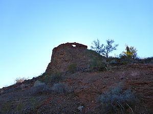
Casting Shadows
by kingsnake

Not sure if this is a state park fee use area. Personally, just to be careful, I picked up an Alamo Lake State Park day-use permit before heading towards the trailhead.


It is about two miles of pure jeep trail hiking from the pullout / old campground to the arch. Because I was doing some other things in the area, I approached the arch from the northeast, which gives a good profile shot if it is mid-afternoon. It is a steep & slippery climb up the northeast face, but not too bad. Once on top, turn left along a narrow ledge to the arch opening. The arch itself is tiny and delicate -- do not climb on it. There is a safe shelf to sit on the arch's southwest face. If you peer through it, towards the northeast, with a mid-afternoon sun, you can see the arch's shadow, complete with sunny spot, on the desert floor. I've never experienced that before! Makes it worth your time.
remove free decal offer
The arch's southwest slope is mild, and I descended that way, following a fairly obvious foot trail, back to the jeep trail. You could also go up the southwest face, but then you would miss the profile shot unless you went down the steep & slippery northwest face. I'd do it the way I did: Counter-clockwise.

2015-01-04 kingsnake


    Check out the Official Route and Triplog.
    Leave No Trace and +Add a Triplog after your hike to support this local community.

    One-Way Notice
    This hike is listed as One-Way.

    When hiking several trails on a single "hike", log it with a generic name that describes the hike. Then link the trails traveled, check out the example.
    WARNING! Hiking and outdoor related sports can be dangerous. Be responsible and prepare for the trip. Study the area you are entering and plan accordingly. Dress for the current and unexpected weather changes. Take plenty of water. Never go alone. Make an itinerary with your plan(s), route(s), destination(s) and expected return time. Give your itinerary to trusted family and/or friends.

     Permit $$
    None


     Directions
    or
     Road
    FR / Jeep Road - Car possible when dry

    To hike
    Whether you travel from Phoenix to Wenden via I-10 or US 60, head north on Alamo Rd. for about 35 miles to Park Rd. (Not sure the exact distance, but Park Rd. is 2.5 miles before the State Park office, and Alamo Rd. is 38 miles long.) Turn right onto dirt Park Rd. for 3.0 miles. At the small community/airstrip, turn left on Wickenburg Rd.; go 2.6 miles to the split at the info sign. Split right on Brown's Crossing Rd. for 2.0 miles to the old campground/pullout on the right. Park there. Cars could probably make the drive; SUVs and up no problem. Past the pullout is strictly 4WD / high clearance, though not requiring great skill. You could drive within a few hundred yards of the arch if you have the vehicle, though you will pick up a few new "Arizona pinstripes".
    page created by kingsnake on Jan 04 2015 4:35 pm
     90+° 8am - 6pm kills
    helpcorrectionissue

    end of page marker