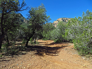
This remote, primitive, scenic, and ideally located "first come/first serve" group or individual vehicle camping-tent camping location bordering a very rugged section of the Sierra Ancha Wilderness just off FR203 north end, offers an excellent base camp location at 4225 feet for numerous, rugged "off-trail" exploratory day hiking opportunities or drives to other Cherry Creek FR203 areas for further off-trail explorations.
With numerous large, level areas for tent and/or vehicle camping also included are a dense and shaded grove of mature oaks and juniper trees to provide shade during the warmer days. Also, a perennial, unnamed slow flow spring seep is only a ~.125 mile hike from camp (Please note that this campsite area off FR203 is often active with cattle ranging so water treatment and/or filtering is highly recommended).
WARNING! Hiking and outdoor related sports can be dangerous. Be responsible and prepare for the trip. Study the area you are entering and plan accordingly. Dress for the current and unexpected weather changes. Take plenty of water. Never go alone. Make an itinerary with your plan(s), route(s), destination(s) and expected return time. Give your itinerary to trusted family and/or friends.
Permit $$
None
Directions
Road
Strictly 4x4
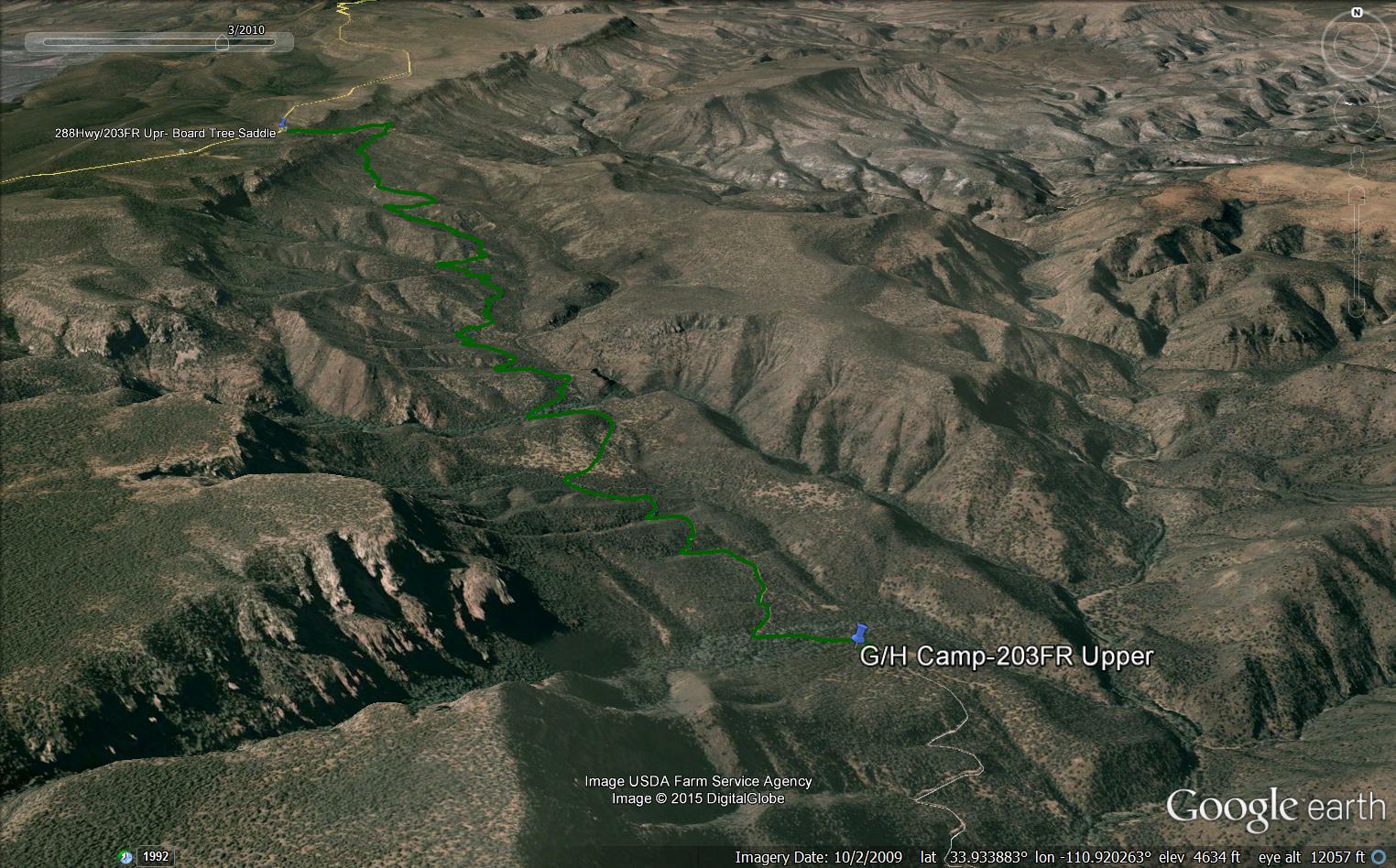
To car camp trip From the Phoenix area- Take Hwy 60E to Globe (at MP247) turn north on HWY 188 towards Roosevelt Lake and drive 14.7 miles (at MP229.4) turn right onto HWY 288 The Young Highway. Drive XX.X miles north on Hwy 288 to the intersection of Hwy 288 at Board Tree Saddle(signed) and FR203 Cherry Creek Road North End. Turn Right (NE) onto FR203 and continue driving 6.9 miles mostly downhill on the FR203 slow, rocky-rough, with some 4WD, High Clearance (with LT Rated Tires) distance to the Right Turn (West) intersection with unsigned, short Spur Road into campsite area (Please Note: On FR203 at ~7.0mls down, if you pass the gate/cattle guard then you passed the right turn in to the campsite area). Also, see posted "official" GPS Driving Route from Hwy288 / FR203 North End for review and download.
page created by Grasshopper on Mar 27 2015 7:56 pm
 Route Editor


 This remote, primitive, scenic, and ideally located "first come/first serve" group or individual vehicle camping-tent camping location bordering a very rugged section of the Sierra Ancha Wilderness just off FR203 north end, offers an excellent base camp location at 4225 feet for numerous, rugged "off-trail" exploratory day hiking opportunities or drives to other Cherry Creek FR203 areas for further off-trail explorations.