|
tap row or icons for details
|
| Difficulty |
|
2.5 of 5 |
| Route Finding |
|
1 of 5 |
| Distance Round Trip |
|
3 miles |
| Trailhead Elevation |
|
6,140 feet |
| Elevation Gain |
|
540 feet |
| Kokopelli Seeds |
|
5.7 |
| Interest Peak | | unreported if dogs are allowed
editedit > ops > dogs to adjust |
| | |
|
|
|
list |
map |
done |
Salt Lake Region |
| | |
|
| |
|
|
Historical Weather |
| Trailhead Forecast | | |
|
 |
|
|
| Preferred May, Sep, Oct, Jun |
|
|
| | |
| |
Named Locations Coordinate Links
| |
|
| help future hikers |
| post a gps route now |
| | |
| |
|
|
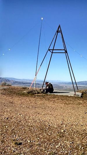
 From the gate start hiking up the road. Along the way are other smaller roads that take you off from the route you want. Stay on the main road, past a second road that makes a sharp switchback and follow it as it descends and gradually ascends again. As you near the benchmark the road becomes much steeper. At the top is a strange looking tripod used for triangulation, I’m told. This hike offers great views of both Salt Lake City and Utah Valley.
|
 Route Editor