Route Editor

| Guide | ♦ | 9 Triplogs | 0 Topics |
details | drive | no permit | forecast | route |
stats |
photos | triplogs | topics | location |
| 67 | 9 | 0 |
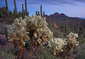
When Wickenburg gets unbearably boring... by JoelHazelton  Although a relatively small mountain range just a stone's throw away from Wickenburg, the Vulture Mountains offer beauty and feelings of remoteness and solitude that are difficult to find in even some of the larger mountain ranges near Phoenix. Several roads and primitive campsites wind through these mountains, mostly occupied with large RVs and vans, but the rewards found in hiking the trails still exist. One such trail leads to Dana's Arch. My source for this trail was "Wickenburg Adventures" by Christine Maxa. If you're interested in some of the desert northwest of Phoenix, it is a very worthy purchase. Although a relatively small mountain range just a stone's throw away from Wickenburg, the Vulture Mountains offer beauty and feelings of remoteness and solitude that are difficult to find in even some of the larger mountain ranges near Phoenix. Several roads and primitive campsites wind through these mountains, mostly occupied with large RVs and vans, but the rewards found in hiking the trails still exist. One such trail leads to Dana's Arch. My source for this trail was "Wickenburg Adventures" by Christine Maxa. If you're interested in some of the desert northwest of Phoenix, it is a very worthy purchase.The trail is unsigned and begins on an old jeep track that drops steeply from the parking area into a wash and then climbs back up the other side. After about 100 yards, the road forks- take the left fork. In another hundred yards, the trail to the arch branches out on the left and is marked with small cairns on either side. Keep your eye out for these cairns, or you'll miss it!
It is quite easy to hike up to the arch. If you take a direct route to it, you will have to do a bit of climbing, but it's super fun. If you don't want to climb, then head up to the saddle to the north (left) of the rock formations that form the arch. This will involve some bushwhacking, but it's a very easy walk. Once up the saddle, the ridgeline to the right (south) is flat, and it's a quick stroll to the arch. Enjoy the view of Vulture Peak from up here, as it's a different angle than what people usually see of this Wickenburg landmark. Once you're done, either return the way you came or, if you have a map, form an off-trail loop of sorts. Enjoy! Check out the Official Route and Triplogs. Leave No Trace and +Add a Triplog after your hike to support this local community. | ||||||||||||||||||||||||||||||||||||||||||||||||||||||||||||||||||||||||||||||||||