Route Editor

| Guide | ♦ | 1 Triplog | 0 Topics |
details | drive | permit | forecast | route |
stats |
photos | triplog | topics | location |
| 40 | 1 | 0 |
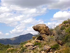
More stabby than a dark alley on payday by kingsnake  I was looking for hikes east of Yarnell for summer 2015, and in the course of scanning FS Topo, I noticed this location. I had planned to make a loop of this and nearby Camp Bird Mine, but off-trail was extremely stabby, so I settled for doing this alone. Combining the two sites, plus checking various nearby springs, would make for a more satisfying distance and AEG. I was looking for hikes east of Yarnell for summer 2015, and in the course of scanning FS Topo, I noticed this location. I had planned to make a loop of this and nearby Camp Bird Mine, but off-trail was extremely stabby, so I settled for doing this alone. Combining the two sites, plus checking various nearby springs, would make for a more satisfying distance and AEG.I tried googling for info on who, or what, Paxton was, but Google was no help. If there is a historical record, it is buried in a dusty library archive.
The last couple hundred yards up to Ridges Spring, some rubber/plastic pipe is adjacent to the jeep trail. There are two spring boxes at Ridges Spring, one cement and one metal. The spring itself is amongst some reeds just a bit higher up, and there is a metal cap on it. There is some overburden next to the spring, so maybe someone dug down to the spring, more like a well? Kinda weird seeing a spring on the side of a hill instead of down low. It looks like a foot/horse trail continues out the back of the spring, which may connect over to Camp Bird Mine. (I did not proceed.) You will want to avoid bushwhacking the short distance across the spur to Paxton Place. If you fail to heed this sage advice, I hope you bought a bag of plasma with you. Instead, return about .4 miles down the jeep trail, then turn right on a worse jeep trail down to the wash. Follow the wash about a half-mile until you start spotting the occasional bit of metal or rusted tin can. Paxton Place is just up on the left (north). I spent a good bit of time and hemoglobin exploring around Paxton Place. There may be other stuff, but this is all I found: Two dry cement tanks, what looked like a mini-mill wall, two foundations and some wall overlooking the wash (along with what looked like glass from a shattered window), and just a bit uphill, another bit of foundation, which was inlaid with decorative rocks. The two nearby mine features -- a shaft and an adit -- were collapsed almost to unrecognizability. There are tailings everywhere. I did not see any obvious minerals, but there was quite a bit of granite, many instances having shiny gold flecks (doubtless gold in color only). Still, there might be some interesting minerals about—otherwise, time to head back to the TH. Check out the Official Route and Triplog. Leave No Trace and +Add a Triplog after your hike to support this local community. | |||||||||||||||||||||||||||||||||||||||||||||||||||||||||||||||||||||||||||||||||||||