 Route Editor

| Guide | ♦ | 3 Triplogs | 0 Topics |
details | drive | no permit | forecast | map |
stats |
photos | triplogs | topics | location |
| 24 | 3 | 0 |
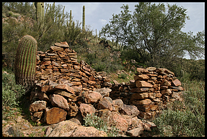
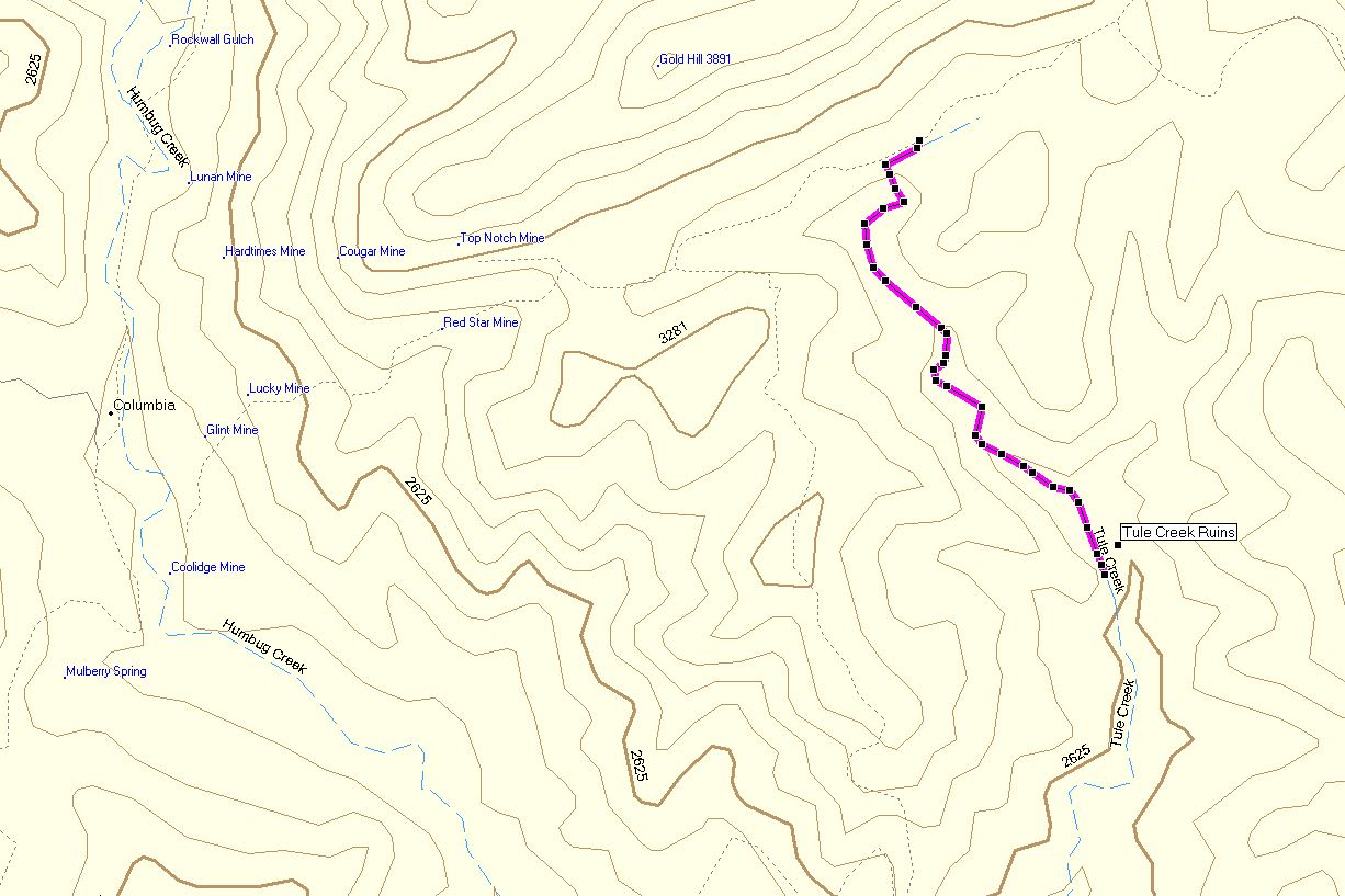
Because it's on the map by skatchkins  Another one of those, "Getting there is half the Battle," type trips. 4 Wheel Drive is a must for the hill climb, although there are three different roads you could essentially come in on. For this report, we'll use the passage through the old mining town of Columbia. Not too difficult, this road due to its steepness and loose rock should not be considered during wet weather. The road passes numerous named and unnamed mines and gives way to great expansive views rolling all the way out to Lake Pleasant. When the road touches the beginnings of Tule Creek, the hiking begins. Another one of those, "Getting there is half the Battle," type trips. 4 Wheel Drive is a must for the hill climb, although there are three different roads you could essentially come in on. For this report, we'll use the passage through the old mining town of Columbia. Not too difficult, this road due to its steepness and loose rock should not be considered during wet weather. The road passes numerous named and unnamed mines and gives way to great expansive views rolling all the way out to Lake Pleasant. When the road touches the beginnings of Tule Creek, the hiking begins.Route finding is accomplished by following the creek downstream, as any footpath has long been erased. Be prepared to bank dance from side to side as the thorned vegetation closes in often. This will add to your trip distance and time. After only a few minutes in, a ruin almost closed over by trees, can be found. Although it is quite small, it still offers a chimney. The other ruins lie at the end of the journey down to the spring. There are plenty of holding spots for water, so be aware of wildlife. Near the destination, there is quite a drop where Tule meets another creek. Going around to the right is the best option, and the set of ruins on the East bank can be seen from this vantage point. Once this site is reached, the last set is visible back across the creek. This site is the largest, with at least two separate buildings and some lower structures below.
Check out the Triplogs. Leave No Trace and +Add a Triplog after your hike to support this local community. One-Way Notice This hike is listed as One-Way. When hiking several trails on a single "hike", log it with a generic name that describes the hike. Then link the trails traveled, check out the example. | ||||||||||||||||||||||||||||||||||||||||||||||||||||||||||||||||||||||||||||


