 Route Editor

| Guide | ♦ | 2 Triplogs | 0 Topics |
details | drive | no permit | forecast | route |
stats |
photos | triplogs | topics | location |
| 22 | 2 | 0 |
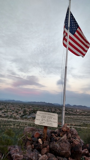
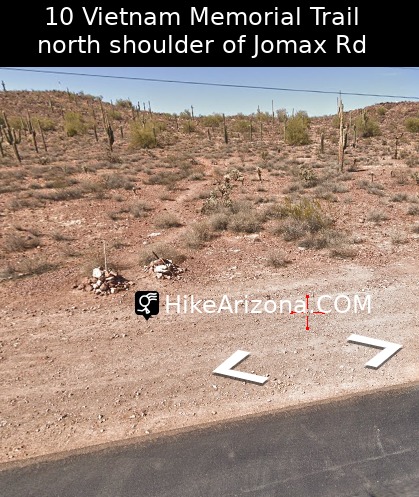
As one of the designers of this trail by mikepag  The Vietnam Memorial Trail is 1050 ft. to the flag and then another 1613 ft. to the top. There are 44 plaques, honoring some of our fallen veterans, and some interesting details and statistics regarding the war. The final plaque and an American flag are less than 1/4 mile up the trail and continues for about ½ mile, after the flag. There are 8 benches along the path to the flag. The Vietnam Memorial Trail is 1050 ft. to the flag and then another 1613 ft. to the top. There are 44 plaques, honoring some of our fallen veterans, and some interesting details and statistics regarding the war. The final plaque and an American flag are less than 1/4 mile up the trail and continues for about ½ mile, after the flag. There are 8 benches along the path to the flag.Youtube about the trail
Check out the Official Route and Triplogs. Leave No Trace and +Add a Triplog after your hike to support this local community. | ||||||||||||||||||||||||||||||||||||||||||||||||||||||||||||||||||||||||||||||||||


