username
X
password
register
for free!
help
 This is likely a great time to hike this trail!  Check out "Preferred" months below, keep in mind this is an estimate.
 

Jukebox Cave, UT

Guide 1 Triplog  0 Topics
  2 of 5  
Fav
Wish
0
details
drive
no permit
forecast
map
stats
photos
triplog
topics
location
4 1 0
HAZ reminds you to respect the ruins. Please read the Archaeological Resources Protection Act of 1979 & Ruins Etiquette
Statistics
tap row or icons for details
Difficulty 0.5 of 5
Distance One Way 2.5 miles
Trailhead Elevation 4,388 feet
Elevation Gain 190 feet
Kokopelli Seeds 3.13
 Interest Ruins & Historic
unreported if dogs are allowed
editedit > ops > dogs to adjust
feature photo
Photos Viewed All MineFollowing
4  2015-09-23 AZLOT69
Author
author avatar Guides 16,843
Routes 17,472
Photos 24
Trips 1 map ( 6 miles )
Age 28 Male Gender
Location HAZ, TrailDEX
Associated Areas
list map done
Northern Region
Historical Weather
Trailhead Forecast
Expand Map
Preferred May, Oct, Apr, Sep
Sun  6:07am - 7:02pm
0 Route
 
0 Alternative


remove free decal offer

 Likely In-Season!
Guide Needed
Publish Full Detail Guide


Use +Add above to share photos and triplogs
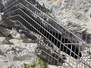
As the story goes airmen from the local Air Force base put a concrete floor in this cave and had dances, hence the name. The cave is part of Utah State Parks and is now known to have archaeological significance. Tours of the cave are given occasionally.


    Check out the Triplog.
    Leave No Trace and +Add a Triplog after your hike to support this local community.

    One-Way Notice
    This hike is listed as One-Way.

    When hiking several trails on a single "hike", log it with a generic name that describes the hike. Then link the trails traveled, check out the example.
    WARNING! Hiking and outdoor related sports can be dangerous. Be responsible and prepare for the trip. Study the area you are entering and plan accordingly. Dress for the current and unexpected weather changes. Take plenty of water. Never go alone. Make an itinerary with your plan(s), route(s), destination(s) and expected return time. Give your itinerary to trusted family and/or friends.

     Permit $$
    None


     Directions
    or
     Road
    FR / Jeep Road - Car possible when dry

    To hike
    Exit 4 northeast an ramp, next road West to parking area.
    page created by AZLOT69 on Sep 24 2015 8:02 am
     90+° 8am - 6pm kills
    helpcorrectionissue

    end of page marker