tap icons for details
|
Difficulty |
|
0.5 of 5 |
Distance One Way |
|
3 miles |
Trailhead Elevation |
|
4,367 feet |
Elevation Gain |
|
200 feet |
Kokopelli Seeds |
|
3.67 |
Interest Off-Trail Hiking, Ruins & Historic | |
| |
|
|
11 |
2023-04-29 | AZLOT69 |
|
|
12 |
2018-12-10 | Steph_and_Blake |
|
|
11 |
2015-09-27 | AZLOT69 |
|
| |
|
|
list |
map |
done |
Central Region |
| | |
|
| |
|
|
Historical Weather |
| Trailhead Forecast | | |
|
 |
|
| Preferred Oct, Apr, Mar, Nov |
|
|
| |
Named Locations Coordinate Links
| |
|
Route
0 Alternative
Water
help future hikers |
post a gps route now |
| | |
 | | Spirit Arch
0.5 mi away
| |
 | | Petroglyph Canyon San Rafael
0.9 mi away
| |
| | Roadside Rock Art
1.6 mi away
| |
| | Three Finger Canyon
6.1 mi away
| |
| | Upper Black Box
9.2 mi away
| |
| | Drilling Derrick
12.4 mi away
| |
| | Candland Mountain Loop Trail
13.7 mi away
| |
| | Ernie Canyon
13.8 mi away
| |
| | Prickly Pear Rock Art
15.7 mi away
| |
| [ View More! ] |
| | no photo labels yet +Add > Photos to this Guide then label as applicable
|
|
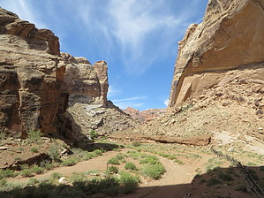
Beautiful high walled canyon to petroglyphs, pictograms. Check out the Triplogs.
2015-10-06
One-Way NoticeThis hike is listed as One-Way. When hiking several trails on a single "hike", log it with a generic name that describes the hike. Then link the trails traveled, check out the example. |