Route Editor

| Guide | ♦ | 2 Triplogs | 0 Topics |
details | drive | permit | forecast | 🔥 route |
stats |
photos | triplogs | topics | location |
| 22 | 2 | 0 |
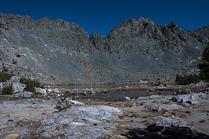
lakes galore by slegal The first part of this description will mirror the Deer Lakes hike. The hike starts out at the Crystal Lake trailhead at Lake George. The trail switches back and forth as it overlooks Lake George.
As you head up a series of switchbacks, you'll get a few obscured views of Crystal Lake through the forest. Eventually, you'll reach a switchback with an unobstructed view of the Mammoth Lakes Basin. From here the tree cover thins and you travel up pumice switchbacks. You'll pass through a section of red cinders. Shortly after passing the cinders you'll reach a trail junction. Both trails meet back up. The left trail is shorter. After the two trails meet again you are on Mammoth Crest. The trail flattens out for a while allowing you some time to recover from the climb. This area is a treeless pumice field. Just ahead you can see the final climb before you reach Deer Lakes. The trail heads uphill through a whitebark pine forest. The Crest along this route rises from an elevation of about 10,600 feet to about 11,200 feet. This is not that steep a climb. After reaching the high point of the hike you will reach a chute overlooking the eastern part of the Mammoth Lakes Basin. Across the basin is a great view of Pyramid Peak. After passing the shoot, the trail flattens out briefly before descending steeply down to the Deer Lakes. As you approach the lakes you will see your next ascent out of the Deer Lakes Basin. After passing the first lake, well off the trail to your right, you will arrive at the next two lakes off to the left. There is a good campsite just to the right. If it is not occupied, it is a good shady spot to stop and have lunch. Continuing on, there is a split in the trail. There is no sign, because the trail ceases to be a forest service maintained (or even recognized) trail. Take the right fork and head uphill. There is a little route finding needed along this stretch because at times the trail disappears. Eventually, you will reach a ridge and the last of the deer lakes will be off to your right. To your left is a steep slope covered with boulders. You can scramble here, but there is a much easier way up. If you look to the left of the lake, you will see what appears to be a trail. To reach this trail you need to descend toward the lake and then head to the trail. This trail is well defined all the way up to the top of the steep climb. It’s also very steep. From the top of the steep part, you’ll have a little more climbing, but the climb is far less strenuous. After finally reaching the crest, you’ll see a small basin in front of you with a trail on the other side of the basin. Head toward that trail. The trail will head over the final crest before descending toward the Duck Pass Trail. Early on, you will see Pika Lake. As you descend, the view of Pika Lake will disappear and it will be a little while before Pika Lake and Duck Lake come into view. The trail remains visible for a while and heads down a very steep and loose section. Hiking poles will come in handy here. Eventually, you will likely lose the trail, as there are many different routes to take. The general direction that you want to take is northeast until you reach the Duck Pass Trail, which will be easy to identify because it is a maintained trail. Head northwest on the Duck Pass trail to Duck Pass. Continue down the Duck Pass Trail past Barney Lake and Skelton Lake. About a quarter of a mile past Skelton Lake is the trail junction with the Emerald Lake Trail. Take the Emerald Lake Trail. Although a maintained trail, the Emerald Lake Trail is not a heavily used trail between Emerald Lake and the Duck Pass trail. This section of trail is quite pretty. Continue down the Emerald Lake Trail past Emerald Lake. About a third of a mile past Emerald Lake is a Trail Junction with the Barrett Lake Trail. Take the Barrett Lake Trail. The Barrett Lake Trail is the trail route between The Coldwater Campground parking lot and Lake George. The trail is long and kind of boring. After 1.7 miles you’ll reach Barrett Lake. Barrett Lake is filled by seasonal streams. In drought years, the water level of Barrett Lake will be low. It’s not a particularly scenic lake. Shortly past Barrett Lake, the trail reaches the junction with the TJ Lake Trail. Take the TJ Lake Trail back to Lake George. The TJ Lake Trail is the final trail in the journey. Shortly after joining the TJ Lake Trail, the trail descends steeply toward Lake George, a sight for sore eyes. Once the trail reaches Lake George, expect lots of traffic on this section of trail. The trail is heavily used by fishermen. The trail wraps around the northeastern side of the lake and then heads slightly uphill through a picnic area. Continue on the trail until you reach the parking area. Enjoy! Check out the Official Route and Triplogs. Note This is a moderately difficult hike. Leave No Trace and +Add a Triplog after your hike to support this local community. | |||||||||||||||||||||||||||||||||||||||||||||||||||||||||||||||||||||||||||||||||||||||||||||||||||