| Guide | ♦ | 6 Triplogs | 0 Topics |
details | drive | no permit | forecast | route |
stats |
photos | triplogs | topics | location |
| 0 | 6 | 0 |
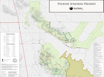
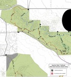
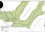
Chain Fruit Connection by AZWanderingBear  The Sonoran Preserve North has seen some trail development on the eastern side lately with the Apache Wash Loop, Badger Brawl, Esplanade and Cliff Walk Trails. Several connector trails provide multiple options for loops and better access. There are now two connectors between the Cliff Walk and Badger Brawl trails. This description is for the northernmost of the two connectors. The Sonoran Preserve North has seen some trail development on the eastern side lately with the Apache Wash Loop, Badger Brawl, Esplanade and Cliff Walk Trails. Several connector trails provide multiple options for loops and better access. There are now two connectors between the Cliff Walk and Badger Brawl trails. This description is for the northernmost of the two connectors.The Badger Brawl trail splits off from the Apache Wash Loop. In approximately 2 miles, the Cliff Walk splits off north to parallel the Cave Creek Wash all the way to the Carefree Highway while the Badge Brawl continues towards the eastern edge of the Sonoran Preserve. Just prior to the end of the Badger Brawl trail a connector trail goes north towards the Esplanade Trail.
This connector, and the other connector trails, provide a means of customizing your hike or bike in the Sonoran Preserve. Just a reminder: There is no water along this trail, or at the Apache Wash Trailhead. Check out the Official Route and Triplogs. Leave No Trace and +Add a Triplog after your hike to support this local community. One-Way Notice This hike is listed as One-Way. When hiking several trails on a single "hike", log it with a generic name that describes the hike. Then link the trails traveled, check out the example. | |||||||||||||||||||||||||||||||||||||||||||||||||||||||||||||||||||||||||||||||||||
 Route Editor


