 Route Editor

| Guide | ♦ | 93 Triplogs | 4 Topics |
details | drive | no permit | forecast | 🔥 route |
stats |
photos | triplogs | topics | location |
| 947 | 93 | 4 |
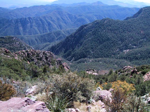
Humphries Buster by Fritzski   This is a loop hike beginning at the Barnhardt Trailhead. It takes the Barnhardt Trail to about the 4-mile point, freestyle your way to the top, then a fairly direct route down to the Y Bar Trail for the return. This is a loop hike beginning at the Barnhardt Trailhead. It takes the Barnhardt Trail to about the 4-mile point, freestyle your way to the top, then a fairly direct route down to the Y Bar Trail for the return.The most difficult hike I've done, surpassing the Superstition Ridgeline in my opinion At over 3700' in elevation gain, I believe it to be the most this side of Tucson or Flagstaff (Weatherford Tr). Within the 12mi loop is a total accumulated gain/loss of over 5100'. Add to this the fact that no trail exists for much of the hike making route-finding and bushwhacking skills a must. Okay, that being said, if you're still with me here's how I tackled it - knowing a multitude of possible routes exists - this one most possibly not being the best. But what the hey, it worked!
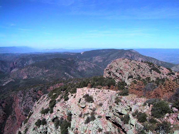
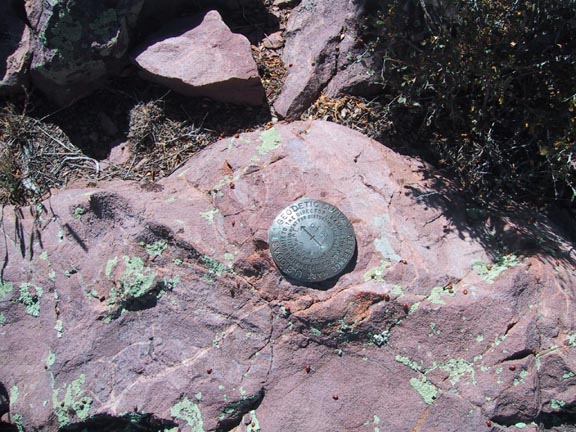
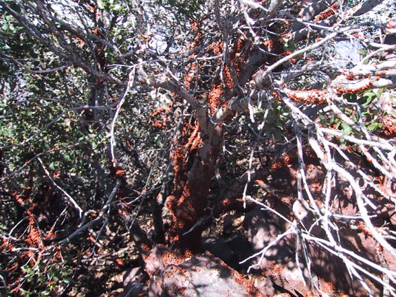
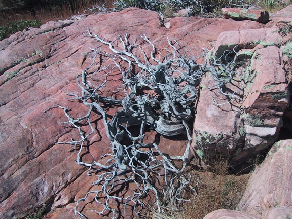
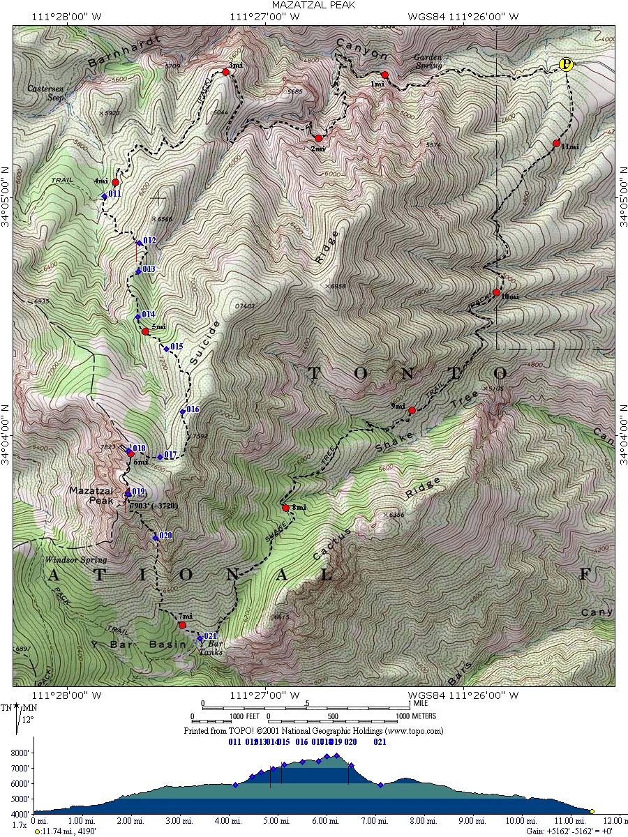 I got to my predetermined point to depart Barnhardt at about the 2.5mi point only to find a forty-foot wall completely blocking that gully. It just happens to be the same wall that forms the well-known "waterfall" on Barnhardt. Jeeze! I should have remembered that. Moving on to find a suitable point of attack I had to bypass the Sandy Saddle Trail intersection and the endless Manzanita forest before settling on a gully right at the 4mi point. There is a beautiful little well-used camping spot on the downhill side of the gully. I got to my predetermined point to depart Barnhardt at about the 2.5mi point only to find a forty-foot wall completely blocking that gully. It just happens to be the same wall that forms the well-known "waterfall" on Barnhardt. Jeeze! I should have remembered that. Moving on to find a suitable point of attack I had to bypass the Sandy Saddle Trail intersection and the endless Manzanita forest before settling on a gully right at the 4mi point. There is a beautiful little well-used camping spot on the downhill side of the gully.After suiting up, it was a full-on brush-crash up the gully. Fortunately, the whacking began to let up at about a half-mile in. Basically from there to the top is a matter of trying to determine the path of least resistance. I did find both my compass and GPS to be of great help. You cannot get a true visual shot of the peak till the very end. The brush is agonizing in areas and the loose rock and thick pine needles can make for precarious footing. I followed a series of gullies and ridges as I slowly meandered toward the top. The rocky peak you first see, and are convinced has to be Maz Peak despite what that "obviously malfunctioning" GPS is telling you, is not. A side trip to this peak as I did, may still be the best way up and offers some stunning views of its own. The actual, and less spectacular, Maz Peak is now plainly visible just a quarter-mile away. The views from the top are very "Four Peaks-ish" with the obligatory survey marker and ladybugs clustered everywhere. The scenery is typically surreal as one would suspect at nearly 8000'. To the south, Four Peaks and the Superstition Ridge punctuate the skyline and down to the west one can easily pick out the Maz Divide Trail far below. My original plan was to return via the same route, but being as difficult as it was, I was sure there must be an easier way down. That was my second mistake. Looking directly down to the south I could see the Y Bar Tanks area of the Y Bar Trail only about 1mi away. On a previous hike having looked up from below at this route (recommended by Grubb in his book "Hiking Arizona's Maz & Supe Mtns") I swore I'd never attempt it. Ever since I read that book I had reservations regarding his judgments and now I know why. The route down this chute is long, steep, treacherous, and the most difficult part of the hike. Very loose rock and bushes making the going slow. When I finally hit the Y bar Trail I just laid there in the middle of the trail for about ten thankful minutes. Anybody who knows the Y Bar Trail knows it's an arduous 4.5-mile slog back to the trailhead. Guess it was just good to be on a trail at all! In retrospect, I would recommend this hike only for those hearty souls feeling in need of bagging the highest peak in central AZ. Take lots of water, long pants, and gaiters if you got 'em. One last note, I took 120oz. of water (20 of it for my mutt), but given the warm temp (94F in the valley that day), it was not enough (that was my third mistake if you're keeping count!). I had some rather bothersome symptoms of dehydration through the last two miles which weren't fun. Talk about timing - got back to the trailhead right at dark after a "fun and frolic" filled ten hours. At least that part worked out according to plan! Check out the Official Route and Triplogs. Note This is a difficult hike. Arrive fit and prepared or this could get ugly. Leave No Trace and +Add a Triplog after your hike to support this local community. | |||||||||||||||||||||||||||||||||||||||||||||||||||||||||||||||||||||||||||||||||||||||||||||||||||||||||||||||||||||||||||||||||||||||||||||||||||||||||||||||||||||||||||||||||||||||||||||||||||||||||||||


