 Route Editor

| Guide | ♦ | 8 Triplogs | 0 Topics |
details | drive | no permit | forecast | map |
stats |
photos | triplogs | topics | location |
| 13 | 8 | 0 |
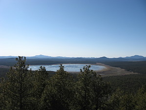
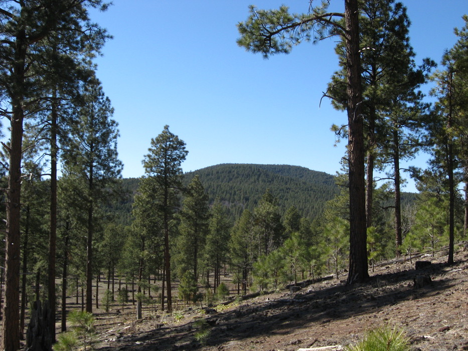
Scenic cross country travel to a minor peak. by Jim   Pitch PitchWoody Mountain has some great views of the area from its summit, and it is a nice hike across pretty scenic terrain. Most people who hike a mountain in the Flagstaff area will usually do Humphrey, Elden, or possibly O'Leary. Overview Woody Mountain is one of the many 8000 foot+ hills that dot the San Francisco Volcanic Field. It would be among several other similar peaks if it were north or west of the San Francisco Peaks. Fortunately, it is relatively isolated southwest of Flagstaff and has enough prominence in the area to host a fire tower. There are an infinite number of ways to access Woody, but if you want paved access to the trailhead, you'll have to come in from the east and 89A.
This description starts across from the Griffith's Springs Day Use Area. If you park on the west side of the road, you should be alright, and it is free. There is a sign for Griffith's Spring. Once parked, climb over or under the barbed wire fence. There is no trail as this is cross country, and you won't see Woody Mountain yet. If you head in a northwest direction, which is about perpendicular to the road, you will walk through a mile or so of recently thinned ponderosa pine that is pretty easy to pass through. After a while, you will come to the end of the thinned area. You will either pass through an area of dense forest before entering another thinned area, or you will walk directly from one thinned area to another. These appear to be where section corners meet, and I think the densely forested land is State Trust Land, but I'm not 100% sure. Continuing on the NW trajectory, you will probably start to see some views of the east summit of Woody Mountain. It looks like a large hill with a wide flat top. This is a view of the east summit from a small knoll (not grassy) about 1 1/2 miles away. Once you have old Woody in your sites, it is a fairly straightforward hike to the summit. You may climb and descend a few "false summits" before you finally start your way up to the true summit. You will have to pass under the power lines just before reaching the final 500 feet of hiking. You may cross one or two well-maintained dirt roads during your approach, and you will meet the Woody Mountain access road near the summit. At the summit, you can climb the fire tower year-round and enter it if someone is staffing it. Before you leave the tower, try to study some more prominent topographic features you should be able to see on your hike back, or use a compass and get a bearing that is southeast of the tower. It's helpful to have something to aid you on your hike back to your car as it can be easy to get turned around if you aren't careful. Special Note There is a great deal of Elk and Pronghorn in the area. I have always seen something when out there. I would guess that hunters are pretty standard in the fall seasons. Pro-lifers might want to wear a loud color. Check out the Triplogs. Leave No Trace and +Add a Triplog after your hike to support this local community. | ||||||||||||||||||||||||||||||||||||||||||||||||||||||||||||||||||||||||||||||||||||||||||


