username
X
password
register
for free!
help
  This is likely a great time to hike this trail!  Check out "Preferred" months below, keep in mind this is an estimate.
  🔥

Hochderffer Hills, AZ

Guide 3 Triplogs  0 Topics
  2 of 5  
Fav
Wish
0
details
drive
no permit
forecast
🔥
route  
stats
photos
triplogs
topics
location
4 3 0
Statistics
tap row or icons for details
Distance One Way 0.9 miles
Trailhead Elevation 9,162 feet
unreported if dogs are allowed
editedit > ops > dogs to adjust
feature photo
Photos Viewed All MineFollowing
14  2024-10-19
Snowy Kachina Aspen Wander
chumley
4  2018-09-29 MountainMatt
Author
author avatar Guides 8
Routes 20
Photos 512
Trips 194 map ( 1,060 miles )
Age 54 Male Gender
Location Mesa, AZ
Co-Author
co-author avatarGuides 16,843
Routes 17,472
Photos 24
Trips 1 map (6 Miles)
Age 28 Male Gender
Location HAZ, TrailDEX
Associated Areas
list map done
Flagstaff Region
Historical Weather
Trailhead Forecast
Radar Map
Expand Map
Preferred Jun, Aug, Jul, Sep
Sun  6:02am - 6:49pm
Official Route
 
0 Alternative
 
Historic Fire Perimeteracres
🔥 1996 Hochderffer Fire17.5k


remove free decal offer
where the hills have a name
by charlieaz & HAZ_Hikebot

  Likely In-Season!
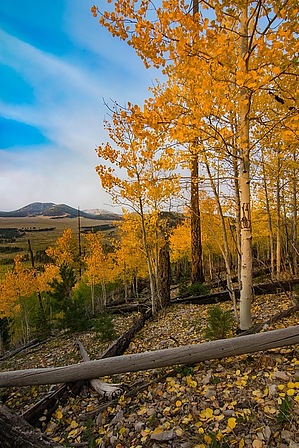
I decided to approach this hike from the Southwest side of Hochderffer Hills. From Fire Road 151E, GPS Coordinates 35.36883 -111.76559 start the bushwhack up the side of the mountain following the ridgeline as much as possible. The heading is east by southeast. After your initial ascent, the hike levels out considerably. You will eventually reach a fence line that you can follow almost to the summit. Pines cover the entire hike with little exposure.


2018-07-14 charlieaz & HAZ_Hikebot


    Check out the Official Route and Triplogs.
    Leave No Trace and +Add a Triplog after your hike to support this local community.

    One-Way Notice
    This hike is listed as One-Way.

    When hiking several trails on a single "hike", log it with a generic name that describes the hike. Then link the trails traveled, check out the example.
    WARNING! Hiking and outdoor related sports can be dangerous. Be responsible and prepare for the trip. Study the area you are entering and plan accordingly. Dress for the current and unexpected weather changes. Take plenty of water. Never go alone. Make an itinerary with your plan(s), route(s), destination(s) and expected return time. Give your itinerary to trusted family and/or friends.

     Permit $$
    no fees or permits reported

    if incorrect tell us about it


     Directions
    or
     Road
    High Clearance possible when dry

    To hike
    From HWY 180 turn right and head east on Fire Road 151 for about 0.4 miles. On the left at 0.4 miles is Fire Road 151E. There is a sign at the entrance indicating the gate may be locked. If open proceed on 151E to a barbed wire second gate. There is a sign at this gate indicting the road is not maintained for passenger vehicles (which is true). Proceed through the gate and drive along 151E for about 2.3 miles to a fork in the road - GPS Coordinates 35.36883 -111.76559 - where you can park and start the hike.
    page created by charlieaz on Sep 25 2016 10:14 am
     90+° 8am - 6pm kills
    helpcorrectionissue

    end of page marker