 Route Editor

| Guide | ♦ | 1 Triplog | 0 Topics |
details | drive | no permit | forecast | 🔥 route |
stats |
photos | triplog | topics | location |
| 15 | 1 | 0 |
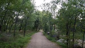
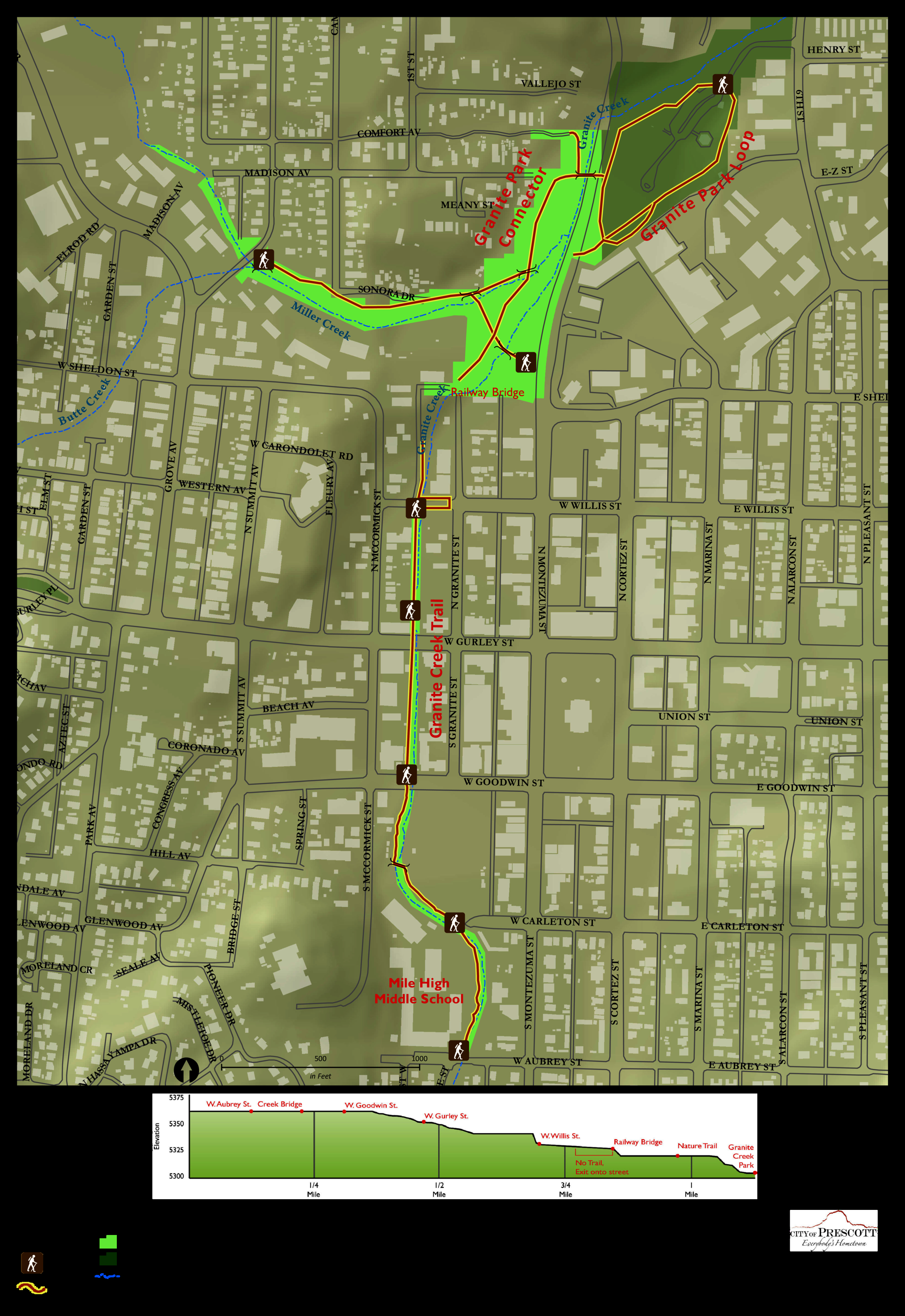
aka Greenways Trail System by Peter_Medal   The Granite Creek Trail connects with the Miller Creek Trail and loops into the A. C. Williams Granite Creek Park, collectively known as the Greenways Trail System. These trail systems are centrally located in the heart of central Prescott. Lush greenery under a forest canopy lines the trails with an abundance of shade. The Granite Creek Trail connects with the Miller Creek Trail and loops into the A. C. Williams Granite Creek Park, collectively known as the Greenways Trail System. These trail systems are centrally located in the heart of central Prescott. Lush greenery under a forest canopy lines the trails with an abundance of shade.The Granite Creek trail runs one block west of the infamous Whiskey Row which sides the Courthouse Square.
The Granite Creek portion extends from Aubrey Street at Mile High Middle School (south entrance) and meanders north to the Granite Creek Park. The Miller Creek portion extends from Grove & Lincoln (west entrance) and connects to the Granite Creek trail which continues northeast under the Laguardia Bridge (Montezuma Street) into Granite Creek Park. There are EIGHT entries onto the trail system: 1. Aubrey Street just west of Montezuma Street (Whiskey Row), Mile High Middle School West Entrance 2. Carlton Street just west of Montezuma Street, Mile High Middle School East Entrance. 3. Goodwin Street Bridge, North side of Goodwin, West side of Bridge (El Gato Azul Restaurant stairwell). 4. Gurley Street, south side stairwell by Dinner Bell Cafe 5. Willis Street, between Mccormick & Granite Street. 6. Sheldon Street & Montezuma Street. There is a free city parking lot here. 7. Grove & Lincoln Street (NEC). This is the Miller Creek entrance. 8. A.C. Williams Granite Creek Park, 554 6th St, Prescott, AZ 86301 The most logical entry point for an ideal trailhead would be either the free parking lot (#6) on Montezuma Street or driving into Granite Creek Park.
Check out the Official Route and Triplog. Leave No Trace and +Add a Triplog after your hike to support this local community. | ||||||||||||||||||||||||||||||||||||||||||||||||||||||||||||||||||||||||||||||||||||||||


