 Route Editor

| Guide | ♦ | 7 Triplogs | 1 Topic |
details | drive | no permit | forecast | route |
stats |
photos | triplogs | topic | location |
| 10 | 7 | 1 |
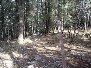
Iron Clad Route... by imike This trail drops down from the Rim trail in the upper reaches of the Sacramento Mountains, connecting to an old access road for the Alamogordo waterworks, allowing servicing of their cast iron pipe that carries water down the mountain to the city far below. It is interesting to listen to the gurgle of the water rushing down the still active pipe that runs along the roadbed.
The trailhead for T110 lies on the far side of Atkinson Meadow. The road access and parking orient to the near east side, where you can choose from a variety of pull offs under the trees. Once parked, walk down into the meadow, and over to the obvious trail heading off into the pines on the southwest side. That trail will climb up to the juncture of T110, T111 and the Rim Trail, T105. There is a large Forest Service sign dedicating the Rim Trail and smaller signage orienting T110. T110 terminates at the lower end into Alamo Canyon Trail, T109. There are a number of potential loops that can be combined to form a day's hiking... or complete the trek back up the hill on T110. Note: Fire Danger often closes this forest in May and June... check before planning a springtime trip. Check out the Official Route and Triplogs. Leave No Trace and +Add a Triplog after your hike to support this local community. One-Way Notice This hike is listed as One-Way. When hiking several trails on a single "hike", log it with a generic name that describes the hike. Then link the trails traveled, check out the example. | ||||||||||||||||||||||||||||||||||||||||||||||||||||||||||||||||||||||||||||||||||||||||||||


