Route Editor

| Guide | ♦ | 5 Triplogs | 0 Topics |
details | drive | no permit | forecast | map |
stats |
photos | triplogs | topics | location |
| 5 | 5 | 0 |
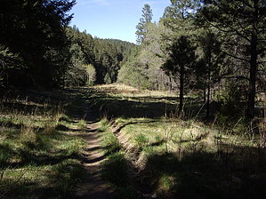
Power Up!! by imike From the Trailhead in the Village, follow T5001A the less than half mile over to the juncture with T5001 (Cloud-Climbing Trestle Trail) and T5002 (Old Cloudcroft Hiway Trail). Turn left onto the Old Hiway Trail (T5002) and follow it down to the old hiway grade (just a few yards downhill). Here, T5002 turns sharply right. Instead, turn left on the old hiway grade and make your way along this unmaintaned and possibly overgrown portion of the old road bed. Proceed for a bit over 100 yards, and as you approach the county maintaince yard, move off the hiway grade, following the old trail/road horseshoeing down the drainage. The path remains clear and easy to follow to the bottom. You will pass through the metal gate in the first half mile, then continue down the hill, accompanied by an assortment of high power lines.
This route does avoid the concentration of tourist activity so typical to the upper trails. Elk, Deer, Wild Turkey are common to this drainage. Gate Policy: If a gate is closed upon arrival, leave it closed after you go through. If it is open, leave it open. Leaving a closed gate open may put cattle in danger. Closing an open gate may cut them off from water. Please be respectful, leave gates as found. The exception is signage on the gate directing you otherwise. Check out the Triplogs. Leave No Trace and +Add a Triplog after your hike to support this local community. | |||||||||||||||||||||||||||||||||||||||||||||||||||||||||||||||||||||||||||||||||||||||||||||