 Route Editor

| Guide | ♦ | 1 Triplog | 0 Topics |
details | drive | no permit | forecast | route |
stats |
photos | triplog | topics | location |
| 9 | 1 | 0 |
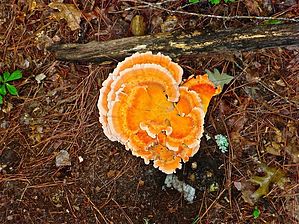
They don't fall far by kingsnake  The Campbell Creek Loop is a five mile lasso from the Raven Rock State Park Visitor Center. It is marked by a blue disk. The trail is wide, of hard packed sand, and sometimes Carolina red clay. There are only scattered roots and golf ball sized rocks, so footing isn’t an issue.
The footing is iffier west of the pit toilet, but still not bad. Also, fewer of the side creeks are “bridged”. There’s a couple of rest benches along the way. Other than 100 yds. by the visitor center, the hike is totally in heavy forest. Hiking counterclockwise, the trail follows the west bank of Campbell Creek. Two miles into the hike, there is an unnamed side trail that continues along Campbell Creek as it empties into the Cape Fear River. Unless you want to explore, you should instead turn left. Campbell Creek is about 30 ft. wide and up to 6″ deep, with 10 ft. banks of slippery clay. Flow was audible, but not heavy. A quarter mile after the false turn is the Lanier Falls Trail. The quarter mile, one way, side trail to Lanier Falls is marked by a red triangle. Don’t get lost. ;-p Also, mind your footing, as there is a lot of slippery clay and boulders near Lanier Falls. Lanier Falls was nothing spectacular — more like a small rapids — but moving a lot of water. A quarter mile past the Lanier Falls Trail is a pit toilet, the only facilities on the Campbell Creek Loop. You otherwise will need to risk ticks peeing in the woods. What little elevation gain there is, is small up & downs. The only “climb” is on the return, ascending the lasso’s handle 200 ft. back to the visitor center trailhead. Check out the Official Route and Triplog. Leave No Trace and +Add a Triplog after your hike to support this local community. One-Way Notice This hike is listed as One-Way. When hiking several trails on a single "hike", log it with a generic name that describes the hike. Then link the trails traveled, check out the example. | ||||||||||||||||||||||||||||||||||||||||||||||||||||||||||||||||||||||||||||||||||


