 Route Editor

| Guide | 0 Triplogs | 0 Topics |
details | drive | no permit | forecast | route |
stats |
photos | triplogs | topics | location |
| 10 | 0 | 0 |
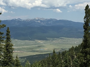
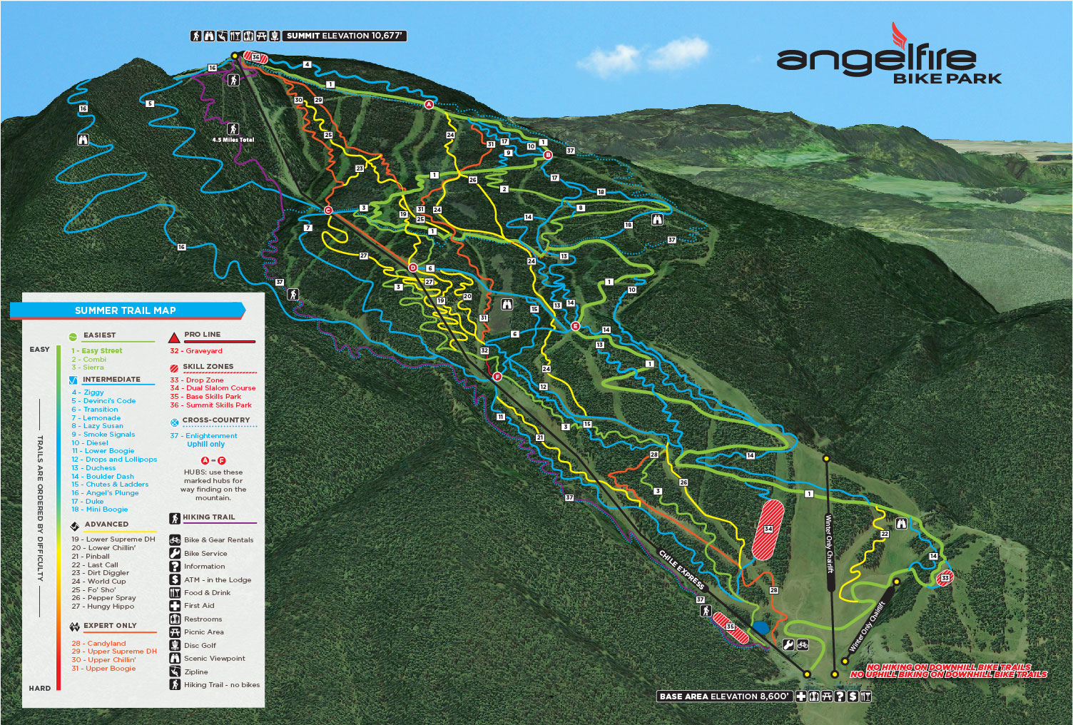
Aka: Aqua Fria Peak by rvcarter Hike: The hiking trail doesn’t have a name, but shares the uphill only Enlightenment Cross Country Ski Route for about ¾ of the way. Check out the map The start of the hiking trail is not well marked, but park just past the lower lift station and walk up hill. Most of the cars will belong to bikers taking the short coast down to the lift station to ride sans aerobic difficulty up the mountain. Go up from the parking lot and look for an obvious opening. There is a sign after a bit confirming that you are indeed on the hiking trail. This is one of the nicest trails I’ve been on; think a paved sidewalk covered with grass or soft dirt. All the downed trees and debris have been removed. It’s well marked where any interaction with biking downhillers could occur. The slope is steep at a few spots, but never feels hard. However, at 10,000+ feet, it will seem hard, so take it at your pace. Until you reach the point where the hiking trail separates from the “Enlightenment Trail”, all you see is excellent wooded terrain, and occasionally hear the bikers to your right discourse on their way down. After the departure, the trail narrows and becomes much steeper. Near the top, you encounter the lower end of the zipline routes, and cross the upper end of the canyon to turn right. This part of the trail leads to the top, emerging at the upper end of the long zipline.
Check out the Official Route. Leave No Trace and +Add a Triplog after your hike to support this local community. One-Way Notice This hike is listed as One-Way. When hiking several trails on a single "hike", log it with a generic name that describes the hike. Then link the trails traveled, check out the example. | ||||||||||||||||||||||||||||||||||||||||||||||||||||||||||||||||||||||||||||||||||||||||


