 Route Editor

| Guide | ♦ | 1 Triplog | 0 Topics |
details | drive | no permit | forecast | route |
stats |
photos | triplog | topics | location |
| 11 | 1 | 0 |
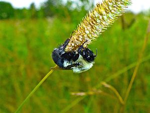
Getting Drenched at the Rusty Spur Saloon by kingsnake As on the two Ice Age Trail segments north of Croooked Lake, the trail basically follows the “high line” of a low ridge, the better to avoid the swampy kettles — the depressions that give Kettle Moraine State Park its name — that dot the ridge’s flanks.
The Ice Age Trail between Crooked Lake and New Fane is mostly very smooth, enabling me to spend more time looking for #flowerporn than ankle breakers. Sometimes it is wide, but mostly it is narrow. It is frequently over grown with grass, but still distinguishable if you look for bent grass. There are regular muddy patches, particularly near this segment’s four small, wooden, bridges. The Ice Age Trail crosses the first two bridges just before it passes by Forest Lake, barely visible through the trees. Soon after, the trail crosses County GGG / Kettle Moraine Scenic Drive. As the Ice Age Trail approaches Mauthe Lake, it skirts a camping area, and an especially swampy kettle known as Mallard Hole Lake. After crossing the third bridge, the Ice Age Trail breaks out into the open at the entrance to Mauthe Lake Recreation Area. There’s a pit toilet at the entrance. There’s no fee to walk in, but vehicle admission is $8/day with Wisconsin plates, $11/day for out of state plates, or $5 for a quick one hour visit. The Ice Age Trail then enters the Milwaukee River & Swamp State Natural Area. The fourth bridge crosses a creek feeding the marsh. Shelter #2 is about a mile south of the Mauthe Lake access road. It is a wood building with a dirt floor. Basically, enough to keep you dry at night if you are doing a long distance hike. There is an outhouse near the shelter. The Ice Age Trail splits just north of Shelter #2, then rejoins just south of it, so if you do not see the shelter, you took the incorrect split. The Ice Age Trail crosses County S just south of Shelter #2. A mile south of County S, the trail bends to the west, which is different than the topo, which shows the trail continuing south. The attached GPS track shows the actual route. Just as New Fane comes into view, on a small bluff overlooking the East Branch of the Milwaukee River and New Fane Mill Pond, there is a bench. While it may look like there is a trail down the bluff from the bench, but it leads to private property. Stay on the Ice Age Trail, which soon descends to County DD. The Ice Age Trail continues — for almost 1,000 miles — south and west of County DD. As there is no good pullout near the trail on County DD, the best pickup spot is in New Fane, at the Rusty Spur Saloon. If you hike from Crooked Lake to Mauthe Lake, and back, it will be a six mile, 600 AEG hike. If you hike from Crooked Lake to New Fane, rehydrate at the Rusty Spur Saloon, then hike back, it will be a 13 mile, 1200 AEG hike. Throwing in the Tamarack Circle Nature Trail will add three miles and 100 AEG to your excursion. Check out the Official Route and Triplog. Leave No Trace and +Add a Triplog after your hike to support this local community. One-Way Notice This hike is listed as One-Way. When hiking several trails on a single "hike", log it with a generic name that describes the hike. Then link the trails traveled, check out the example. | |||||||||||||||||||||||||||||||||||||||||||||||||||||||||||||||||||||||||||||||


