Route Editor

| Guide | ♦ | 7 Triplogs | 0 Topics |
details | drive | no permit | forecast | 🔥 route |
stats |
photos | triplogs | topics | location |
| 38 | 7 | 0 |
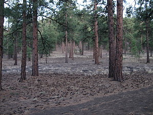
Cave Hill's Backside by hippiepunkpirate   Like the more popular route via the Silver Saddle TH, this hike won't likely appeal to many beyond the local Flagstaffians. However, it should be considered as a no-cost alternative if you are too stingy to pay the entrance fee to Sunset Crater Volcano National Monument. The scenery is similar, although not as amazing as the Bonito Lava Flow and such areas. For the locals, it adds variety to the local catalog of hikes. The Landfill TH seems less utilizing than the Silver Saddle TH, so parking may be easier to find during peak hours of use. By the way, Old Caves Crater is referred to as "Cave Hill" by most who live in the nearby Doney Park area. Like the more popular route via the Silver Saddle TH, this hike won't likely appeal to many beyond the local Flagstaffians. However, it should be considered as a no-cost alternative if you are too stingy to pay the entrance fee to Sunset Crater Volcano National Monument. The scenery is similar, although not as amazing as the Bonito Lava Flow and such areas. For the locals, it adds variety to the local catalog of hikes. The Landfill TH seems less utilizing than the Silver Saddle TH, so parking may be easier to find during peak hours of use. By the way, Old Caves Crater is referred to as "Cave Hill" by most who live in the nearby Doney Park area.Hike To reach the trail up to the summit, you'll need to follow a leg of the loop trail that surrounds Cave Hill. From the trailhead, a short section connects to the loop, but first intersecting with pipeline access road. A signed junction soon indicates the loop trail, and the route to the summit. Signs guide you as social trails criss-cross. Sections of loose sand make the relatively flat terrain a little more challenging. The trail to the summit will soon take off, and it has some steepness to it. Views, of the Peaks, Mount Elden, Sunset Crater and O'Leary Peak arise as you ascend. You will probably pass the summit without realizing it. The stats above indicate an out and back to the summit. You might want to explore the caves, which requires descending a little ways down the other side. It is possible to do a loop up and over, and then back to the car via either the east or west sections of the circumference loop. Up, over and back via the east section is 3.3 miles. Up, over and back via the west section is a longer 4.2 miles. Check out the Official Route and Triplogs. Leave No Trace and +Add a Triplog after your hike to support this local community. | ||||||||||||||||||||||||||||||||||||||||||||||||||||||||||||||||||||||||||||||||||||||||||||