username
X
password
register
for free!
help
  

Backyard Canyon, AZ

Guide 1 Triplog  0 Topics
  0 of 5  
Fav
Wish
0
details
drive
permit
forecast
route  
stats
photos
triplog
topics
location
7 1 0
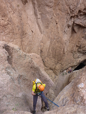
Canyons are inherently risky. Flash floods occur without notice on sunny days. Technical skills & surrounding topography knowledge required yet does not eliminate risk.
Statistics
tap row or icons for details
Distance Round Trip 3.1 miles
Trailhead Elevation 1,640 feet
Elevation Gain 1,121 feet
Accumulated Gain 1,121 feet
Kokopelli Seeds 8.71
unreported if dogs are allowed
editedit > ops > dogs to adjust
feature photo
Photos Viewed All MineFollowing
7  2017-12-16 azflyguy
Author
author avatar Guides 16,843
Routes 17,472
Photos 24
Trips 1 map ( 6 miles )
Age 28 Male Gender
Location HAZ, TrailDEX
Historical Weather
Trailhead Forecast
Radar Map
Expand Map
Preferred Mar, Nov, Feb, Apr
Sun  6:03am - 6:47pm
Official Route
 
0 Alternative


remove free decal offer

Guide Needed
Publish Full Detail Guide


Use +Add above to share photos and triplogs
Fun 3BIII canyon with 3 raps max ~90'.

Happy

Trails!


    Check out the Official Route and Triplog.
    Leave No Trace and +Add a Triplog after your canyon trip to support this local community.
    WARNING! Hiking and outdoor related sports can be dangerous. Be responsible and prepare for the trip. Study the area you are entering and plan accordingly. Dress for the current and unexpected weather changes. Take plenty of water. Never go alone. Make an itinerary with your plan(s), route(s), destination(s) and expected return time. Give your itinerary to trusted family and/or friends.

     Permit $$
    Bulldog Canyon OHV permit
    The permit is free, but a $6 processing fee is required to obtain from www.recreation.gov (tap get permit)
    The permit is good for 6 months. Upon purchase, you'll be given the gate codes to get through the gate.
    Warning
    FR1356 is sandy in some sections and is a bit rocky in other sections, so a 4WD vehicle will be needed to drive this road.


     Directions
    or
     Road
    FR / Jeep Road - Car possible when dry

    To FR10 near Bulldog (arbitrary/unofficial) Trailhead
    The trailhead is at a parking pullout on the left side of FR 10, about 1.5 miles inside of the Blue Point Bulldog Canyon OHV locked gate on Bush Highway. The trailhead coordinates are 33.52663, -111.57309.

    You will need a permit (see permits) to get inside the locked gate; however, the permit is free for the asking.

    From PHX (I-10 & AZ-51) 47 min (34.9 miles)
    From TUC (Jct 1-10 & Grant) 2 h 4 min (124 miles)
    From FLG (Jct I-17 & I-40) 2 h 46 min (178 miles)
    (Trailhead is generic)
    page created by azflyguy on Dec 17 2017 1:26 pm
     90+° 8am - 6pm kills
    helpcorrectionissue

    end of page marker