Route Editor

| Guide | ♦ | 3 Triplogs | 0 Topics |
details | drive | no permit | forecast | 🔥 route |
stats |
photos | triplogs | topics | location |
| 55 | 3 | 0 |
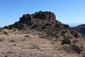
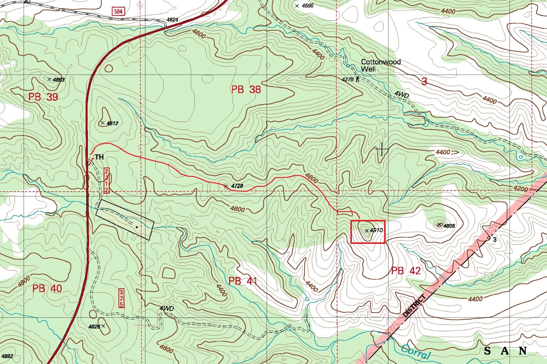
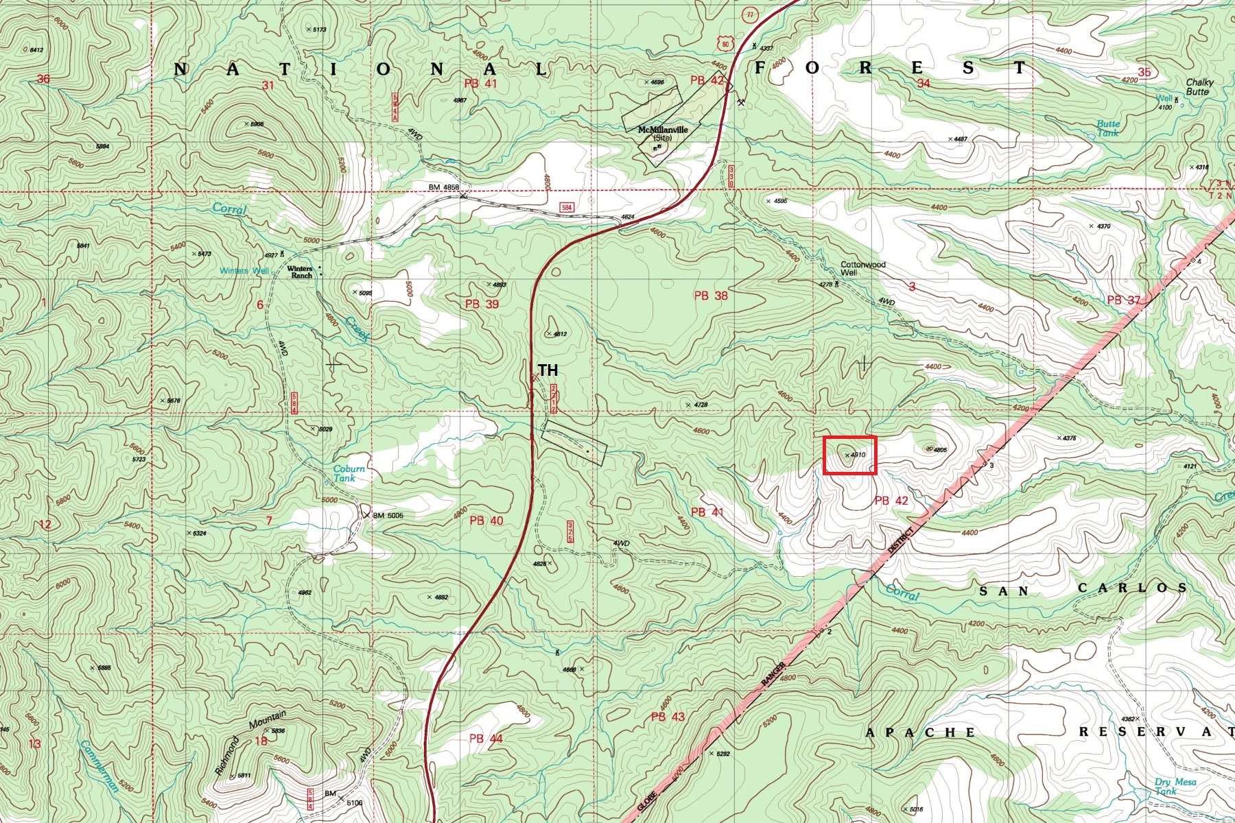
  Large scenic butte Indian ruin site located within the Tonto National Forest bordering the western San Carlos Apache Indian Reservation boundary. The site consists of about 13 rooms perched atop a large rugged cliff lined butte. Reaching the ruins requires negotiating a short easy scramble route on the northeast edge (see posted GPS route). A great destination for those with a love for ancient Indian history and off-trail adventure. The hike is an easy off-trail rolling ridge top route with light to moderate bushwhack at times. Large scenic butte Indian ruin site located within the Tonto National Forest bordering the western San Carlos Apache Indian Reservation boundary. The site consists of about 13 rooms perched atop a large rugged cliff lined butte. Reaching the ruins requires negotiating a short easy scramble route on the northeast edge (see posted GPS route). A great destination for those with a love for ancient Indian history and off-trail adventure. The hike is an easy off-trail rolling ridge top route with light to moderate bushwhack at times.
Check out the Official Route and Triplogs. Leave No Trace and +Add a Triplog after your hike to support this local community. | ||||||||||||||||||||||||||||||||||||||||||||||||||||||||||||||||||||||||||||||||||