 Route Editor

| Guide | ♦ | 2 Triplogs | 0 Topics |
details | drive | no permit | forecast | map |
stats |
photos | triplogs | topics | location |
| 22 | 2 | 0 |
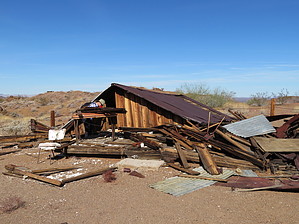
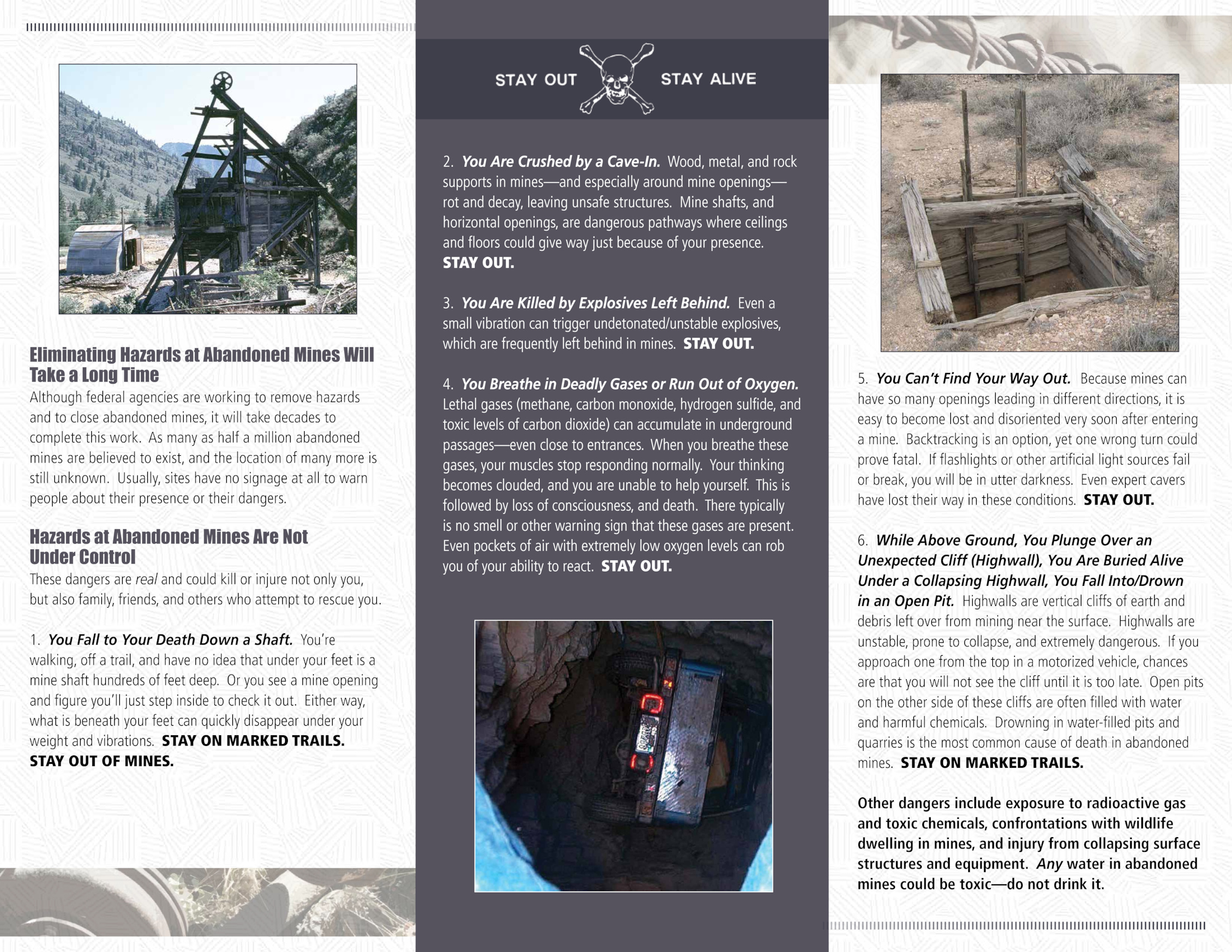
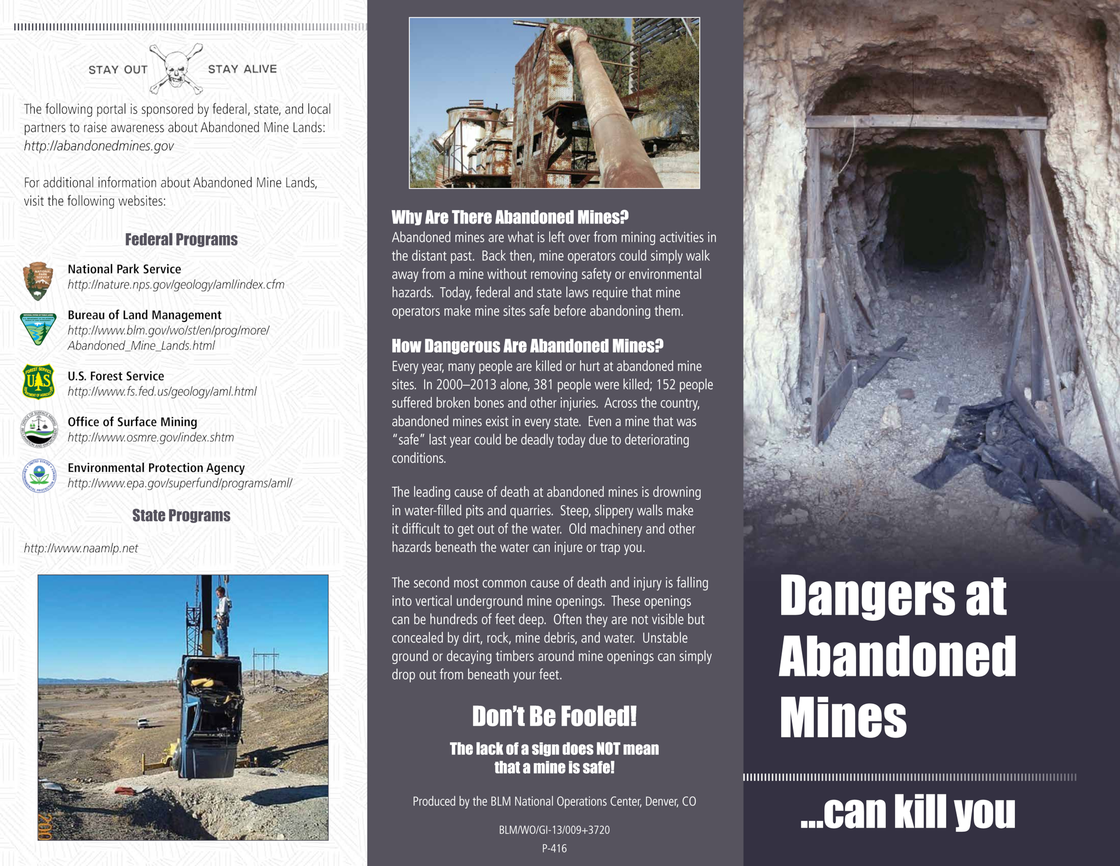
This is a meandering hike to check out various historical sites. It will leave you asking many questions. Few answers are provided. Enjoy! Warning The cabin is no longer safe to enter. Also, abandoned mines are dangerous. For more details on mine safety check out this publication by BLM.gov: Page1, Page 2 History Charley Brown came to what is now known as the Turtle Mountain Wilderness back in 1922 in search of gold and silver. Charley built the historic cabin and he and his business partner, Jesse Craik, lived there while prospecting. The inn was dubbed The Lost Arch Inn in Charley's later years as visitors passing by were always welcomed. Charley lived there until he died in 1948.
From our campsite, we could see the vestiges of a stamping mill and a tin roof off in the distance. We knew them to be Charley Brown’s camp and mine and wanted to check it out. We mostly followed jeep trails, but sometimes struck out cross-country if something caught our eye. We hiked up to the concrete foundation of the stamping mill, postulating how they’d brought in the mined rock and why there were so little tailings. From there we (Blake) briefly peeked into a large mine and quickly left as there was a large number of bees entering and leaving the tunnel. We hiked over to another, smaller tunnel and then down to Charley Brown’s cabin. The walls of the cabin have mostly collapsed, but there are plenty of interesting “artifacts” laying around. Our next stop was a collection of old, rusty vehicles that the BLM had gathered and cordoned off for viewing. We then sauntered over to the second area of concrete foundations and walls and tried to figure out their original purposed. We were particularly perplexed by what at first seemed like a cement holding tank for water, except that it had a doorway. Hhmmm…Onward we hiked to find a gravesite located on a small rise. The rocks of the ‘grave’ were placed to presumably cover the body and there was no headstone. Wade noted that the grave was in line with an arch high in the mountains to the south and Charlie Brown’s camp, which he felt wasn’t a coincidence. Our last stop on the tour was the Lisa Dawn camp. There we saw the remains of stone walls, what was left of a concrete pad, and what we called the “can dump”. There were probably no less than a hundred rusted cans of various sizes. I guess Waste Management didn’t get out this far back in the day. We returned to our campsite to rest in the shade.
Check out the Triplogs. Leave No Trace and +Add a Triplog after your hike to support this local community. | |||||||||||||||||||||||||||||||||||||||||||||||||||||||||||||||||||||||||||||||||||


