|
tap row or icons for details
|
| Trailhead Elevation |
|
1,839 feet |
| Backpack Possible - Not Popular | |
| | |
|
|
2 |
2018-02-05 | Steph_and_Blake |
|
|
1 |
2018-02-05 | Steph_and_Blake |
|
| |
|
|
| |
|
|
Historical Weather |
| Trailhead Forecast | | |
|
 |
|
|
| Preferred Feb, Nov, Jan, Mar |
|
|
|
Seasons Late Autumn to Late Spring |
|
|
| | |
| |
Named Locations Coordinate Links
| |
|
| help future campers |
| post a gps route now |
| | |
| |
|
|
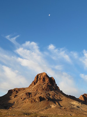
 This campsite is east of the northeastern portion of the Turtle Mountain Wilderness. It provides easy access to Mohawk Springs, Lost Arch Mine, Charley Brown Camp and Mine, Lisa Dawn Camp, Coffin Springs, and the Obsidian Deposit. The other two "official" campsites (near the Lost Arch Mine and the Charley Brown Camp) provide a shade structure and a picnic table, but you might be inundated with day-trip off-roaders. The campsite we chose is between the two official camps, is level, and elevated enough such that you can get a good view of the points of interest you can visit. One down-side to the campsite is that there is a plethora of cholla balls everywhere. There is no water in the area, no toilets, no trash cans. Practice LNT. Campfires are allowed but you must first get a permit (free) from the state of California. Bring your own wood or harvest downed, dead trees. |
 Route Editor