username
X
password
register
for free!
help
 

Medicine Lodge, WY

Guide 1 Triplog  0 Topics
  3 of 5  
Fav
Wish
0
details
drive
no permit
forecast
map
stats
photos
triplog
topics
location
17 1 0
HAZ reminds you to respect the ruins. Please read the Archaeological Resources Protection Act of 1979 & Ruins Etiquette
Statistics
tap row or icons for details
Difficulty 1 of 5
Route Finding 2 of 5
Distance Multi-Loop 4 miles
Trailhead Elevation 4,675 feet
Elevation Gain 290 feet
Accumulated Gain 345 feet
Avg Time Round Trip 2 hours
Kokopelli Seeds 5.73
 Interest Ruins & Perennial Creek
 Backpack No
unreported if dogs are allowed
editedit > ops > dogs to adjust
feature photo
Photos Viewed All MineFollowing
17  2018-07-21 AZLOT69
Author
author avatar Guides 177
Routes 249
Photos 10,213
Trips 2,215 map ( 17,459 miles )
Age 74 Male Gender
Location Gold Canyon, AZ
Associated Areas
list map done
Central North & NW Region
Historical Weather
Trailhead Forecast
Expand Map
Preferred May, Jun, Jul, Aug → 9 AM
Seasons   Early Spring to Late Autumn
Sun  5:36am - 6:41pm
0 Route
 
0 Alternative


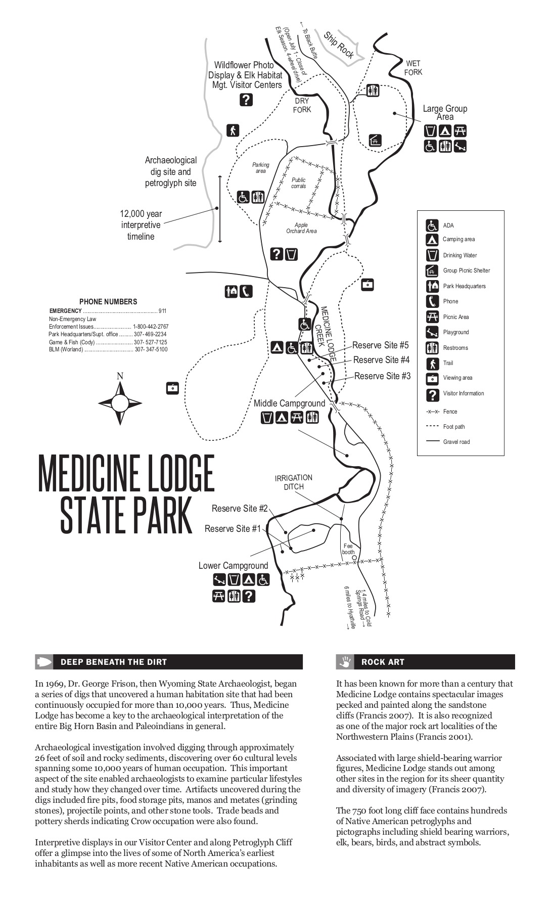
Seeking Experienced Shaman
by AZLOT69


Lying in an idyllic valley in the shadow of the Big Horn Mountains, this land most recently was a working cattle ranch. The land was obtained by the Wyoming State Parks in 1973. Subsequent archaeological surveys have uncovered evidence indicating this land has been occupied for 10,000 years.


• Upon Large sandstone cliffs there are various drawings in the form of petroglyphs, pictograms, and incised drawings. Many of these drawings are on top of others begging the question which came first. We will leave that for the experts to determine.
remove free decal offer
• There is no charge for day use. A nominal fee for camping.

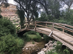
• There are two dedicated trails in the park and there are tens of thousands of adjoining acreage for the more adventurous. The two dedicated trails take in this beautiful valley along the beautiful clear water of Medicine Lodge Creek. You also take in the historic cabins as well as the old cattle ranch buildings which now house a visitor's center with artifacts.

• The highlight of the area is the sandstone cliffs which with the aid of a pamphlet and placards they attempt to make sense of the hundreds of drawings.

2018-07-23 AZLOT69
  • Park PDF
    guide related
    Park PDF
  • Park PDF Map
    guide related
    Park PDF Map


Check out the Triplog.
Leave No Trace and +Add a Triplog after your hike to support this local community.
WARNING! Hiking and outdoor related sports can be dangerous. Be responsible and prepare for the trip. Study the area you are entering and plan accordingly. Dress for the current and unexpected weather changes. Take plenty of water. Never go alone. Make an itinerary with your plan(s), route(s), destination(s) and expected return time. Give your itinerary to trusted family and/or friends.

 Permit $$
None


 Directions
or
 Road
FR / Dirt Road / Gravel - Car Okay

To hike
Located by taking U.S. Highway 16 , Highway 20 and then State Route 31, turn onto Cold Springs Road.
page created by AZLOT69 on Jul 23 2018 1:04 pm
 90+° 8am - 6pm kills
helpcorrectionissue

end of page marker