 Route Editor

| Guide | ♦ | 13 Triplogs | 0 Topics |
details | drive | no permit | forecast | route |
stats |
photos | triplogs | topics | location |
| 171 | 13 | 0 |
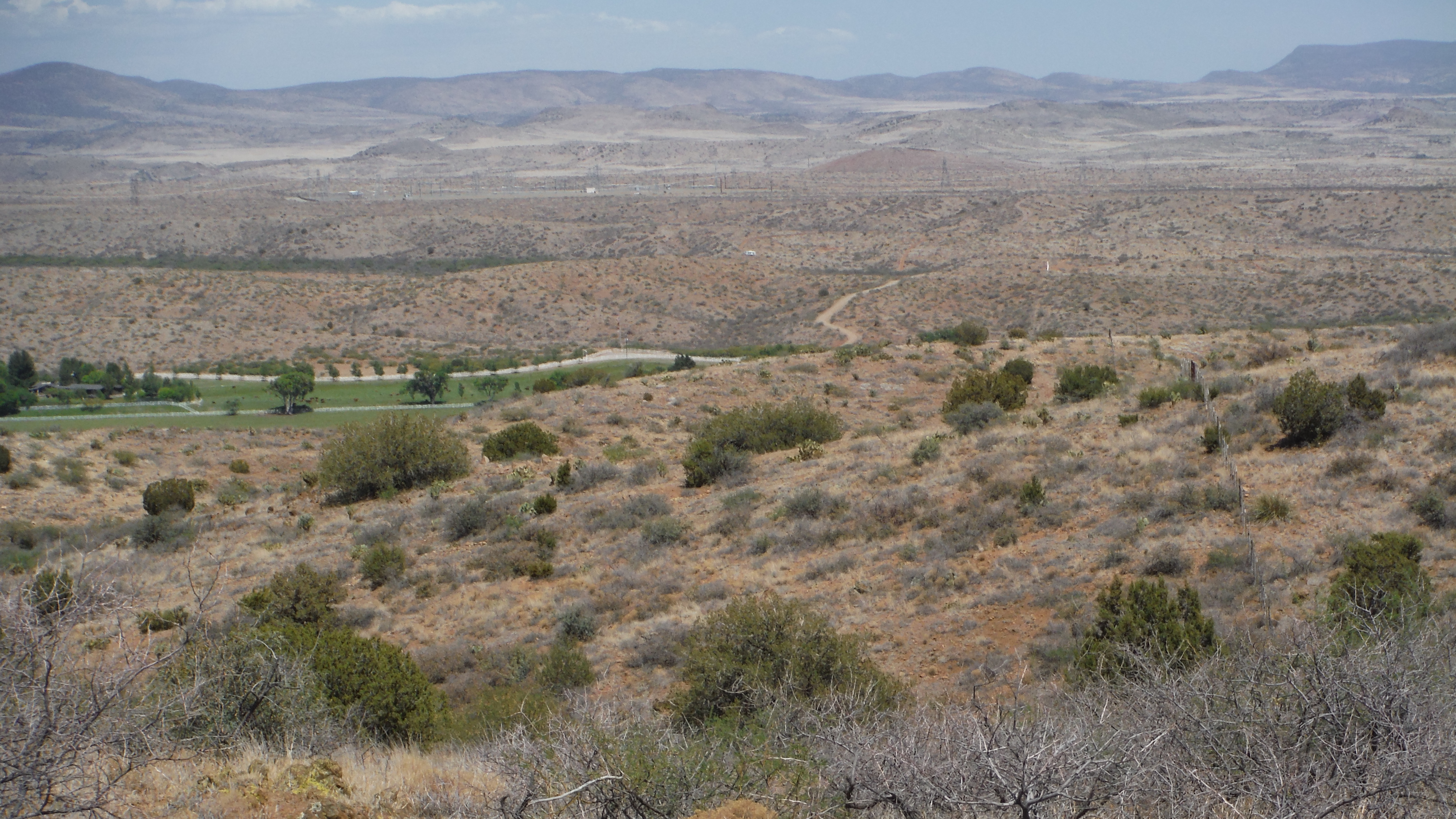
From Bugs to Russia by topohiker   Overview OverviewThe Black Canyon Trail (BCT) is recognized as a National Recreational Trail and, when complete, will meander from Carefree Highway (AZ74) north to the city of Williams (about 130 miles). There are several hike descriptions on this website covering various segments of this trail. This description covers the trail from the Big Bug trail-head to the Russian well. As of this writing, the completed BCT ends about a half-mile north of the Russian well at the Prescott National Forest boundary. This hike has a couple of options. Big Bug TH to Russian Well Loop on the side of Copper Mountain Big Bug TH to a rancher road just north of the Aqua Fria river Or a combination of the above. You can dial in your mileage.
From the Big Bug Trailhead, you go under SR69. Once on the north side of SR69, you’ll see a ranch to the West with Oreo cows. They are very friendly. About 1.6 miles (from the TH), you’ll hit an intersection. Decision time. Going to the left is the Copper Mountain loop. It’s about 8.40 miles on a newly (and nice) constructed trail that meanders along drainages. It provides some views and you travel through the U Cross Ranch. Going to the right (or straight) is the quickest way to get to the Aqua Fria River. Along the way, you’ll pass through the “X lazy B” ranch. The Copper loop terminates at the river gate. You’ll have nice views of the Aqua Fria and the “X lazy B” ranch. The times I cross the Agua Fria River, the river was almost not there. I think the river is underground, and the ranch pumps the water out. The BCT gets very thin and sketchy north of the Aqua Fria. The nice wide trail gets replaced with catclaw and a touch of route finding. Once you get north of an un-named ranching road, the trail gets a bit nicer while the views get bland. About a mile north of the ranching road, you’ll cross through a gate. About 1.4 miles from the gate, you’ll cross a dirt road, and the scenery starts to get more interesting. After a couple of creek/wash crossings, you’ll hit FR9603B and be within a third of a mile of the Russian well. The BCT trail continues about a half-mile down the FR, but this hike ends here. At this point, you're very close to the Prescott National Forest and the Tri-Metals Mine. Gate Policy: If a gate is closed upon arrival, leave it closed after you go through. If it is open, leave it open. Leaving a closed gate open may put cattle in danger. Closing an open gate may cut them off from water. Please be respectful, leave gates as found. The exception is signage on the gate directing you otherwise.
Check out the Official Route and Triplogs. Leave No Trace and +Add a Triplog after your hike to support this local community. One-Way Notice This hike is listed as One-Way. When hiking several trails on a single "hike", log it with a generic name that describes the hike. Then link the trails traveled, check out the example. | |||||||||||||||||||||||||||||||||||||||||||||||||||||||||||||||||||||||||||||||||||||||||||||||||||||||||||||||||||||||||||||||||||||||||||||||||||||||||||||||||||||||||||||||||||||||||


