username
X
password
register
for free!
help
  This is likely a great time to hike this trail!  Check out "Preferred" months below, keep in mind this is an estimate.
  

Coyote Gulch, UT

Guide 7 Triplogs  0 Topics
  5 of 5  
Fav
Wish
1
details
drive
permit
forecast
route  
stats
photos
triplogs
topics
location
141 7 0
Statistics
tap row or icons for details
Distance One Way 8 miles
Trailhead Elevation 4,085 feet
Elevation Gain -381 feet
Accumulated Gain 100 feet
Kokopelli Seeds 8.33
 Interest Off-Trail Hiking, Historic, Perennial Waterfall & Perennial Creek
 Dogs not allowed
feature photo
Photos Viewed All MineFollowing
Inaugural Calculation on Button Tap!
20  2022-10-05 Yoder
29  2022-04-30 ddgrunning
43  2018-09-01
Coyote Gulch
John9L
49  2017-11-23
Coyote Gulch
John9L
Author
author avatar Guides 6
Routes 183
Photos 5,612
Trips 1,647 map ( 11,585 miles )
Age Male Gender
Location Scottsdale, AZ
Co-Author
co-author avatarGuides 16,843
Routes 17,472
Photos 24
Trips 1 map (6 Miles)
Age 28 Male Gender
Location HAZ, TrailDEX
Associated Areas
list map done
Southwest Region
Historical Weather
Trailhead Forecast
Radar Map
Expand Map
Preferred Apr, Oct, May, Sep
Sun  5:57am - 6:49pm
Official Route & 2 Rts
 
2 Alternative


remove free decal offer

  Likely In-Season!
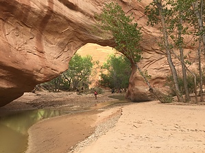
A spectacular canyon located off Hole in the Rock Road south of the town of Escalante. Coyote Gulch features a perennial creek with several waterfalls along the way and ends at the confluence with the Escalante River. It has several access points and can be done as a backpacking trip or a day hike. Most people start from Hurricane Wash. You can obtain the free permit from the visitor center in Escalante or at the kiosk located at the trailhead.


2010-10-02 John9L & HAZ_Hikebot


    Check out the Official Route and Triplogs.
    Leave No Trace and +Add a Triplog after your hike to support this local community.

    One-Way Notice
    This hike is listed as One-Way.

    When hiking several trails on a single "hike", log it with a generic name that describes the hike. Then link the trails traveled, check out the example.
    WARNING! Hiking and outdoor related sports can be dangerous. Be responsible and prepare for the trip. Study the area you are entering and plan accordingly. Dress for the current and unexpected weather changes. Take plenty of water. Never go alone. Make an itinerary with your plan(s), route(s), destination(s) and expected return time. Give your itinerary to trusted family and/or friends.

     Permit $$
    no fees or permits reported

    if incorrect tell us about it

    Glen Canyon NRA National Park
    Glen Canyon Entrance Fee - 1-7 Day Vehicle Pass - $30

    Boat fees are additional, follow provided NPS link above.


     Directions
    or
     Road
    FR / Jeep Road - Car possible when dry

    To hike
    page created by John9L on Oct 02 2018 10:47 am
     90+° 8am - 6pm kills
    helpcorrectionissue

    end of page marker