username
X
password
register
for free!
help
  

Elephant Panel Rock Art, UT

Guide 1 Triplog  0 Topics
  3 of 5  
Fav
Wish
0
details
drive
permit
forecast
map
stats
photos
triplog
topics
location
11 1 0
Statistics
tap row or icons for details
Distance One Way 1.25 miles
Trailhead Elevation 3,979 feet
Elevation Gain 188 feet
Accumulated Gain 322 feet
Kokopelli Seeds 2.32
 Interest Off-Trail Hiking, Historic & Seasonal Creek
feature photo
Photos Viewed All MineFollowing
11  2018-10-10 AZLOT69
Author
author avatar Guides 595
Routes 0
Photos 0
Trips 247 map ( 429 miles )
Age ?
Location
Associated Areas
list map done
Southeast Region
Historical Weather
Trailhead Forecast
Expand Map
Preferred Apr, Oct, May, Mar
Sun  5:53am - 6:39pm
0 Route
 
0 Alternative


remove free decal offer

Guide Needed
Publish Full Detail Guide


Use +Add above to share photos and triplogs
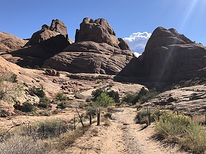
Hike up the jeep road around left tho top of the hill. There are at least ten small canyons now off to your right created by spillover from above. We didn't find any rock art in the first two but continue east and you'll find several panels including the "elephant". Continue to overlook of Moonflower Canyon, then return via the jeep road.


    Check out the Triplog.
    Leave No Trace and +Add a Triplog after your hike to support this local community.

    One-Way Notice
    This hike is listed as One-Way.

    When hiking several trails on a single "hike", log it with a generic name that describes the hike. Then link the trails traveled, check out the example.
    WARNING! Hiking and outdoor related sports can be dangerous. Be responsible and prepare for the trip. Study the area you are entering and plan accordingly. Dress for the current and unexpected weather changes. Take plenty of water. Never go alone. Make an itinerary with your plan(s), route(s), destination(s) and expected return time. Give your itinerary to trusted family and/or friends.

     Permit $$

     Directions
    or
     Road
    FR / Dirt Road / Gravel - Car Okay

    To hike
    From highway 191 downtown Moab locate the McDonald's restaurant and turn west on Kane Springs Blvd. Go 3.5 miles to dirt road going up hill to your left. Trail head is around top of hill on your left. There is an old jeep road but it has been closed. Park not to block drive as there is private residence in the area.
    page created by AZLOT69 on Oct 10 2018 4:59 pm
     90+° 8am - 6pm kills
    helpcorrectionissue

    end of page marker